Bouvet_Map.png
Size of this preview:
787 × 600 pixels
.
Other resolutions:
315 × 240 pixels
|
630 × 480 pixels
|
1,008 × 768 pixels
|
1,280 × 975 pixels
|
2,560 × 1,950 pixels
|
2,804 × 2,136 pixels
.
| Description |
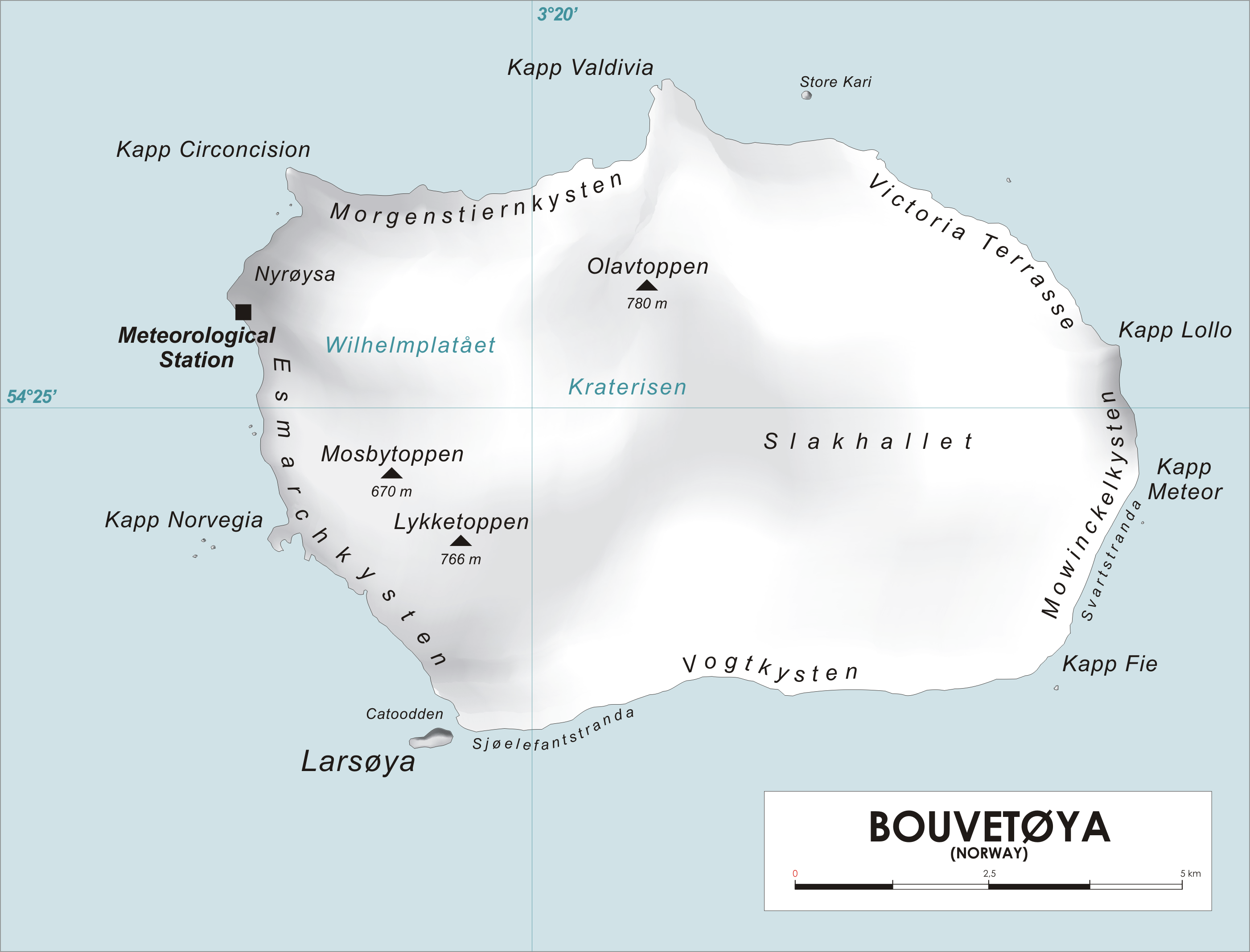
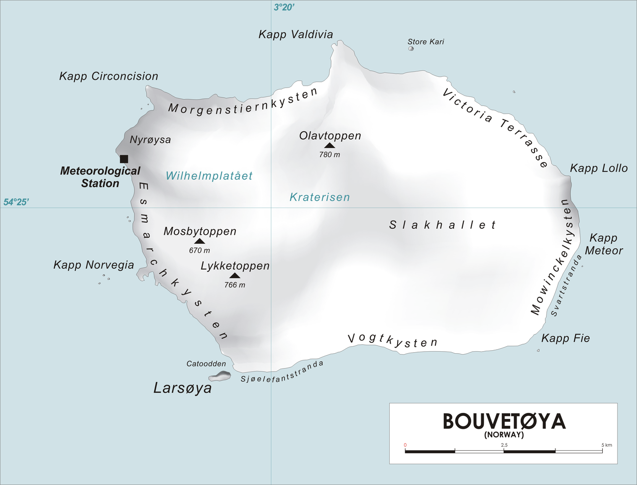
English:
Map of Bouvet Island, Southern Atlantic Ocean
Norsk bokmål:
Kart over Bouvetøya, Sør-Atlanten
|
| Source | Own work |
| Author | varp |
|
|
I, the copyright holder of this work, release this work into the
public domain
. This applies worldwide.
In some countries this may not be legally possible; if so: I grant anyone the right to use this work for any purpose , without any conditions, unless such conditions are required by law. |