Breckland_Heath-Grassland_Ecosystem_-_geograph.org.uk_-_415793.jpg
No higher resolution available.
Summary
| Description |
English:
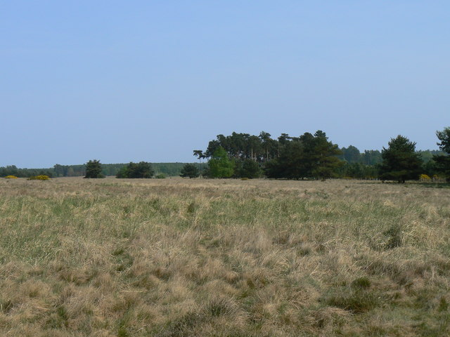
Breckland Heath/Grassland Ecosystem This area is a rare example of a Southern England semi-natural heath habitat, preserved because MOD training in the area limited agriculture, which would have destroyed this rare habitat type.
The Breckland has a semi-continental climate (this region is one of the driest in Britain), so shares many plant species in common with mainlan Europe. Species distribution is governed by management and soil type; alternating chalk and acidic sandy soils over a short distance causes alternating zonation of grassland and heather strips.
|
| Date | |
| Source | From geograph.org.uk |
| Author | Dan Friess |
|
Attribution
( required by the license ) |
Dan Friess / Breckland Heath/Grassland Ecosystem / |
| Camera location |
|
View this and other nearby images on: OpenStreetMap |
|
|---|
_heading:90.00&language=en)
| Object location |
|
View this and other nearby images on: OpenStreetMap |
|
|---|
_heading:90.00&language=en)
Licensing

|
This image was taken from the
Geograph project
collection. See
this photograph's page
on the Geograph website for the photographer's contact details. The copyright on this image is owned by
Dan Friess
and is licensed for reuse under the
Creative Commons
Attribution-ShareAlike 2.0 license.
|
This file is licensed under the
Creative Commons
Attribution-Share Alike 2.0 Generic
license.
Attribution:
Dan Friess
-
You are free:
- to share – to copy, distribute and transmit the work
- to remix – to adapt the work
-
Under the following conditions:
- attribution – You must give appropriate credit, provide a link to the license, and indicate if changes were made. You may do so in any reasonable manner, but not in any way that suggests the licensor endorses you or your use.
- share alike – If you remix, transform, or build upon the material, you must distribute your contributions under the same or compatible license as the original.
- Remove redundant categories and try to put this image in the most specific category/categories
- Remove this template
- The location categories are based on information from this geonames tool and this OpenStreetMap tool combined with a database. You can also have a look at this tool from mysociety .
- The topic category from Geograph was Heathland (find similar images at Geograph )