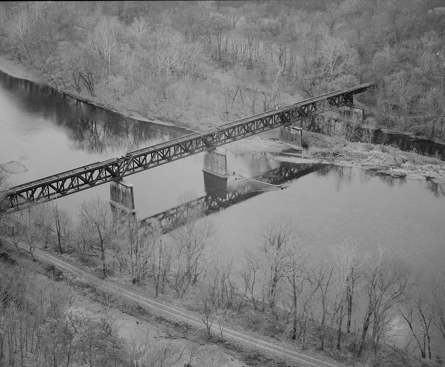
Bridge_No._1317,_First_Potomac_and_C&O_Canal_Crossing,_looking_south._Towpath_in_foreground._-_Western_Maryland_Railway,_Cumberland_Extension,_Pearre_to_North_Branch,_from_WM_milepost_125_to_160,_Pearre,_Washington_County,_MD.jpg
Size of this preview:
727 × 599 pixels
.
Other resolutions:
291 × 240 pixels
|
582 × 480 pixels
|
911 × 751 pixels
.
Summary
| Description |
English:
Bridge No. 1317, First Potomac and C&O Canal Crossing, looking south. Towpath in foreground. - Western Maryland Railway, Cumberland Extension, Pearre to North Branch, from WM milepost 125 to 160, Pearre, Washington County, MD.
|
|||||||||||||||||||||||
| Date | ||||||||||||||||||||||||
| Source | Library of Congress , Prints and Photograph Division HAER : MD-175 | |||||||||||||||||||||||
| Author |
|
|||||||||||||||||||||||
|
Permission
( Reusing this file ) |
|
|||||||||||||||||||||||
.jpg)
| Camera location |
|
View this and other nearby images on: OpenStreetMap |
|
|---|

|
This image is available from the United States
Library of Congress
's
Prints and Photographs division
under the digital ID hhh.md1890 . This tag does not indicate the copyright status of the attached work. A normal copyright tag is still required. See Commons:Licensing .
|