British_Isles_Ireland_higlighted.svg

Size of this PNG preview of this SVG file:
343 × 600 pixels
.
Other resolutions:
137 × 240 pixels
|
274 × 480 pixels
|
439 × 768 pixels
|
586 × 1,024 pixels
|
1,171 × 2,048 pixels
|
675 × 1,180 pixels
.
Summary
| Description |
Deutsch:
Karte des
Vereinigten Königreichs von Großbritannien und Irland
mit Markierung Irlands.
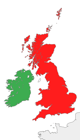
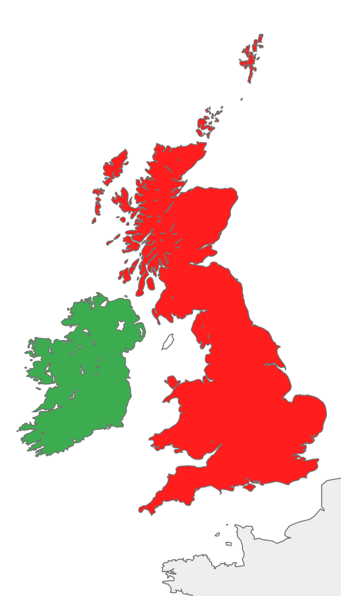
English:
Map of the
island of Ireland and the island of Great Britain
, with green Ireland in green color.
|
||
| Date | |||
| Source |
This file was derived from:
British Isles all.svg
:
|
||
| Author | Furfur | ||
| SVG development |
|
Licensing
I, the copyright holder of this work, hereby publish it under the following license:
|
|
I, the copyright holder of this work, release this work into the
public domain
. This applies worldwide.
In some countries this may not be legally possible; if so: I grant anyone the right to use this work for any purpose , without any conditions, unless such conditions are required by law. |
Original upload log
This image is a derivative work of the following images:
-
British Isles all.svg
licensed with PD-self
- 2012-09-14T08:21:12Z Palosirkka 675x1180 (55591 Bytes) Scrubbed with http://codedread.com/scour/
- 2007-10-20T18:30:43Z Cnbrb 675x1180 (139477 Bytes) == Summary == {{Information |Description=map of Great Britain and Ireland, also known collectively as the British Isles, or the Islands of the North Atlantic |Source=self-made |Date=2007-20-09 |Author= [[User:Cnbrb|Cnbrb]] }}
- 2007-10-20T18:28:26Z Cnbrb 675x1180 (139477 Bytes) == Summary == {{Information |Description=map of Great Britain and Ireland, also known collectively as the British Isles, or the Islands of the North Atlantic |Source=self-made |Date=2007-20-09 |Author= [[User:Cnbrb|Cnbrb]] }}
- 2007-10-20T18:27:20Z Cnbrb 675x1180 (139477 Bytes) == Summary == {{Information |Description=map of Great Britain and Ireland, also known collectively as the British Isles, or the Islands of the North Atlantic |Source=self-made |Date=2007-20-09 |Author= [[User:Cnbrb|Cnbrb]] }}
- 2007-10-20T18:26:33Z Cnbrb 675x1180 (139477 Bytes) == Summary == {{Information |Description=map of Great Britain and Ireland, also known collectively as the British Isles, or the Islands of the North Atlantic |Source=self-made |Date=2007-20-09 |Author= [[User:Cnbrb|Cnbrb]] }}
- 2007-10-20T18:14:52Z Cnbrb 675x1180 (317766 Bytes) == Summary == {{Information |Description=map of Great Britain and Ireland, also known collectively as the British Isles, or the Islands of the North Atlantic |Source=self-made |Date=2007-10-09 |Author= [[User:Cnbrb|Cnbrb]] }}
- 2007-10-20T18:10:39Z Cnbrb 675x1180 (633628 Bytes) == Summary == {{Information |Description=map of Great Britain and Ireland, also known collectively as the British Isles, or the Islands of the North Atlantic |Source=self-made |Date=2007-10-09 |Author= [[User:Cnbrb|Cnbrb]] }}
- 2007-10-20T18:08:30Z Cnbrb 675x1180 (632324 Bytes) == Summary == {{Information |Description=map of Great Britain and Ireland, also known collectively as the British Isles, or the Islands of the North Atlantic |Source=self-made |Date=2007-10-09 |Author= [[User:Cnbrb|Cnbrb]] }}
- 2007-10-20T18:04:37Z Cnbrb 675x1180 (632324 Bytes) == Summary == {{Information |Description=map of Great Britain and Ireland, also known collectively as the British Isles, or the Islands of the North Atlantic |Source=self-made |Date=2007-10-09 |Author= [[User:Cnbrb|Cnbrb]] }}
Uploaded with derivativeFX