Brunei_location_map_Topographic.png

Size of this preview:
739 × 600 pixels
.
Other resolutions:
296 × 240 pixels
|
591 × 480 pixels
|
946 × 768 pixels
|
1,262 × 1,024 pixels
|
2,331 × 1,892 pixels
.
Summary
| Description |
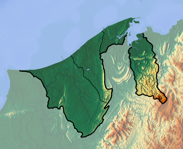
Deutsch:
Positionskarte von
Brunei
Quadratische Plattkarte. Geographische Begrenzung der Karte:
English:
Location map of
Brunei
Equirectangular projection. Geographic limits of the map:
|
| Date | |
| Source |
Own work
|
| Author | Dr Brains |
Licensing
I, the copyright holder of this work, hereby publish it under the following licenses:

|
Permission is granted to copy, distribute and/or modify this document under the terms of the GNU Free Documentation License , Version 1.2 only as published by the Free Software Foundation ; with no Invariant Sections, no Front-Cover Texts, and no Back-Cover Texts. A copy of the license is included in the section entitled GNU Free Documentation License . | 1.2 only |
|
|
Permission is granted to copy, distribute and/or modify this document under the terms of the
GNU Free Documentation License
, Version 1.3 or any later version published by the
Free Software Foundation
; with no Invariant Sections, no Front-Cover Texts, and no Back-Cover Texts. A copy of the license is included in the section entitled
GNU Free Documentation License
.
|
You may select the license of your choice.