Buckie_GNS_railway_station_1932359.jpg
No higher resolution available.
Summary
| Description |
English:
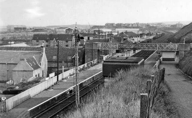
Buckie (GNS) Station.
View eastward, towards Portessie, Cullen and eventually round to Cairnie Junction; ex-Great North of Scotland line, Cairnie Junction via coast to Elgin, closed completely on 6/5/68. (Until 9/8/15 there had been another Buckie Station (off to the right) on a Highland Rly branch from Keith to Portessie). |
| Date | Taken on 2 October 1961 |
| Source | From geograph.org.uk |
| Author | Ben Brooksbank |
|
Permission
( Reusing this file ) |
Creative Commons Attribution Share-alike license 2.0 |
| Camera location |
|
View this and other nearby images on: OpenStreetMap |
|
|---|
Licensing

|
This image was taken from the
Geograph project
collection. See
this photograph's page
on the Geograph website for the photographer's contact details. The copyright on this image is owned by
Ben Brooksbank
and is licensed for reuse under the
Creative Commons
Attribution-ShareAlike 2.0 license.
|
This file is licensed under the
Creative Commons
Attribution-Share Alike 2.0 Generic
license.
Attribution:
Ben Brooksbank
-
You are free:
- to share – to copy, distribute and transmit the work
- to remix – to adapt the work
-
Under the following conditions:
- attribution – You must give appropriate credit, provide a link to the license, and indicate if changes were made. You may do so in any reasonable manner, but not in any way that suggests the licensor endorses you or your use.
- share alike – If you remix, transform, or build upon the material, you must distribute your contributions under the same or compatible license as the original.