C69198s1_Suvorov_Glacier.jpg
Size of this preview:
687 × 599 pixels
.
Other resolutions:
275 × 240 pixels
|
550 × 480 pixels
|
880 × 768 pixels
|
1,174 × 1,024 pixels
|
2,347 × 2,048 pixels
|
3,758 × 3,279 pixels
.
Summary
| Description |
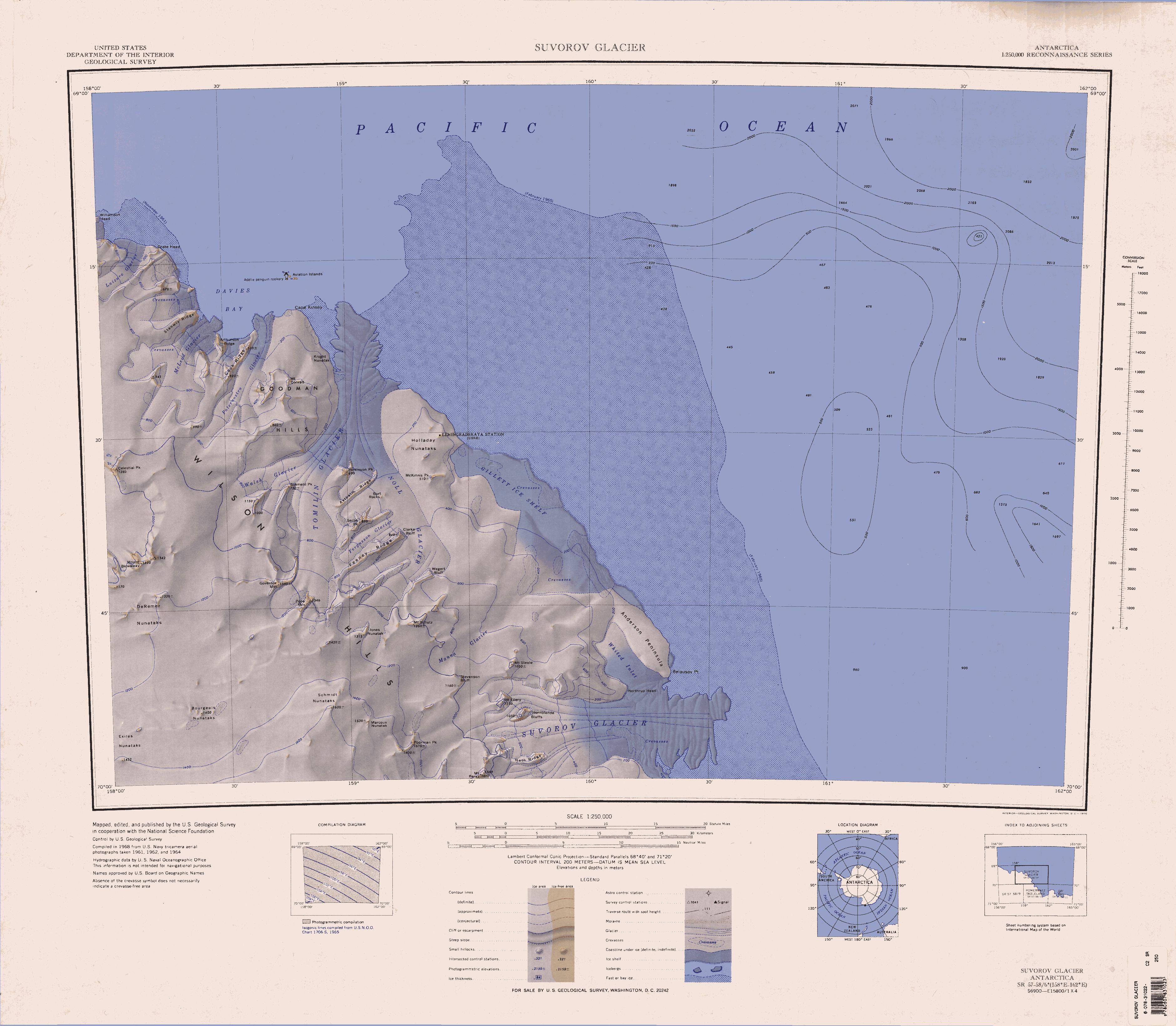
English:
1:250,000-scale topographic reconnaissance map of the Suvorov Glacier area from 158°-162°E to 69°-70°S in Antarctica. Mapped, edited and published by the U.S. Geological Survey in cooperation with the National Science Foundation.
|
|||
| Date | ||||
| Source | http://usarc.usgs.gov/drg_dload.shtml | |||
| Author | United States Geological Survey | |||
|
Permission
( Reusing this file ) |
|