C71192s1_Ant.Map_Ebbe_Glacier.jpg
Size of this preview:
643 × 600 pixels
.
Other resolutions:
257 × 240 pixels
|
515 × 480 pixels
|
823 × 768 pixels
|
1,098 × 1,024 pixels
|
2,196 × 2,048 pixels
|
3,507 × 3,271 pixels
.
Summary
| Description |
English:
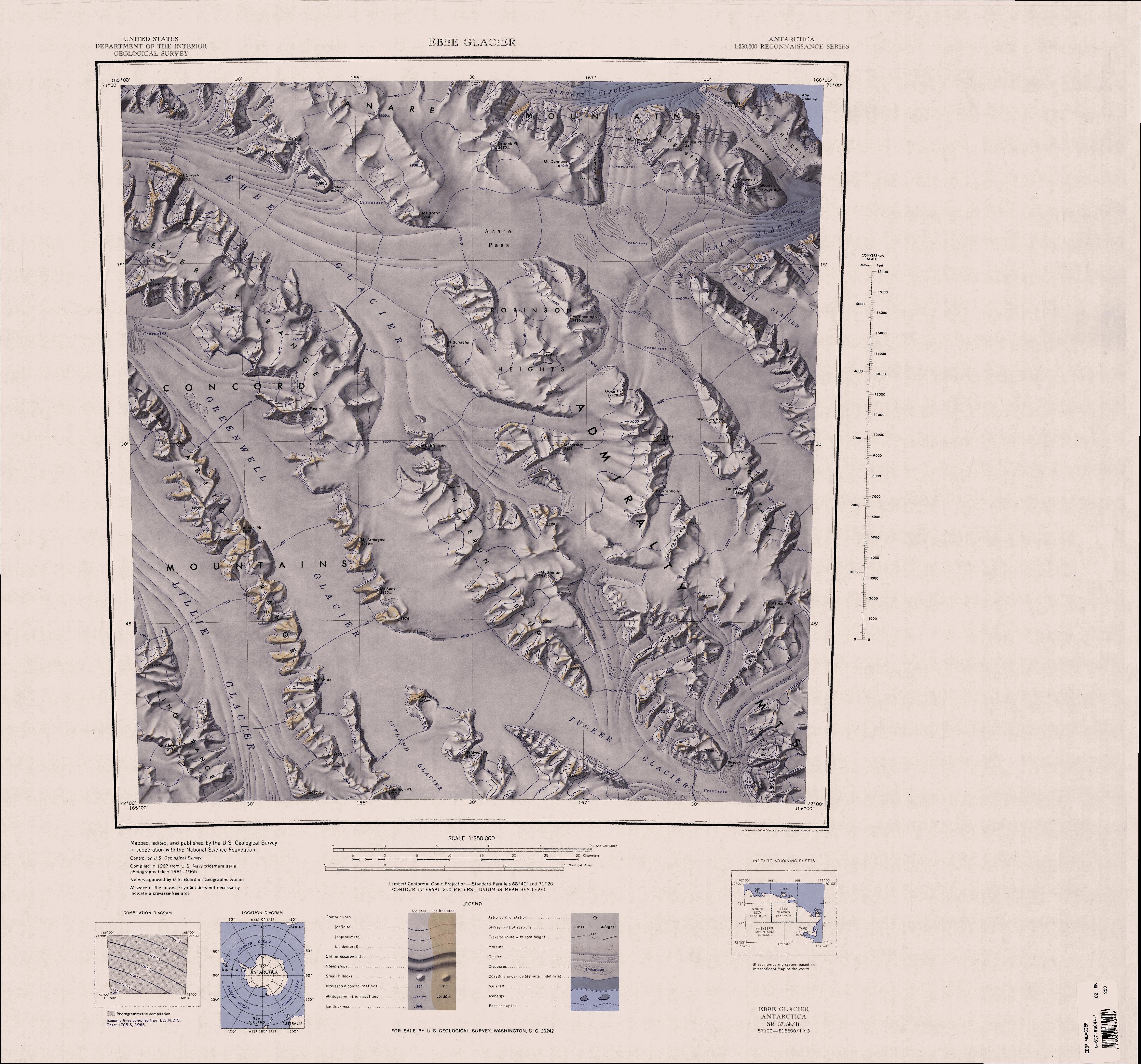
1:250,000-scale topographic reconnaissance map of the Ebbe Glacier area in the Admiralty Range from 165°-168°E to 71°-72°S in Antarctica, including Greenwell, Lillie and Tucker Glacier. Mapped, edited and published by the U.S. Geological Survey in cooperation with the National Science Foundation.
|
|||
| Date | ||||
| Source | http://usarc.usgs.gov/drg_dload.shtml | |||
| Author | United States Geological Survey | |||
|
Permission
( Reusing this file ) |
|