C74130s5_Ant.Map_Grant_Island.jpg

Size of this preview:
708 × 599 pixels
.
Other resolutions:
284 × 240 pixels
|
567 × 480 pixels
|
907 × 768 pixels
|
1,210 × 1,024 pixels
|
2,420 × 2,048 pixels
|
3,882 × 3,286 pixels
.
Summary
| Description |
English:
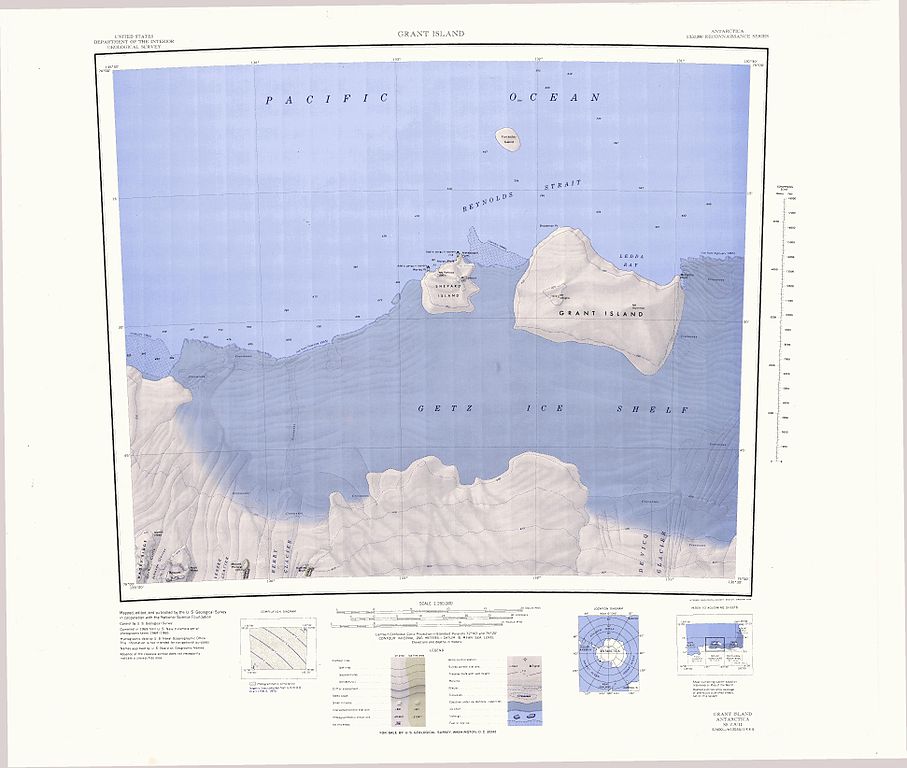
1:250,000-scale topographic reconnaissance map of the Grant Island area from 130°30'-135°W to 74°-75°S in Antarctica, including the western part of the Getz Ice Shelf. Mapped, edited and published by the U.S. Geological Survey in cooperation with the National Science Foundation.
|
|||
| Date | ||||
| Source | http://usarc.usgs.gov/drg_dload.shtml | |||
| Author | United States Geological Survey | |||
|
Permission
( Reusing this file ) |
|