C77198s1_Ant.Map_Taylor_Glacier.jpg

Size of this preview:
795 × 600 pixels
.
Other resolutions:
318 × 240 pixels
|
637 × 480 pixels
|
1,018 × 768 pixels
|
1,280 × 965 pixels
|
2,560 × 1,931 pixels
|
4,312 × 3,252 pixels
.
Summary
| Description |
English:
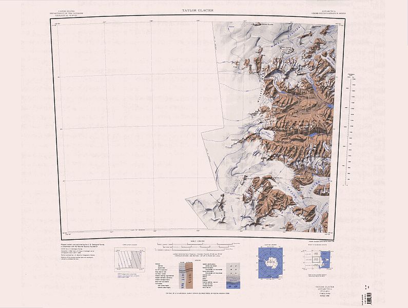
1:250,000-scale topographic reconnaissance map of the Taylor Glacier area from 156°-162'E to 77°-78°S in Antarctica. Mapped, edited and published by the U.S. Geological Survey in cooperation with the National Science Foundation.
|
|||
| Date | ||||
| Source | http://usarc.usgs.gov/drg_dload.shtml | |||
| Author | United States Geological Survey | |||
|
Permission
( Reusing this file ) |
|
| Annotations | This image is annotated: View the annotations at Commons |