CIRCASSIA1840.jpg
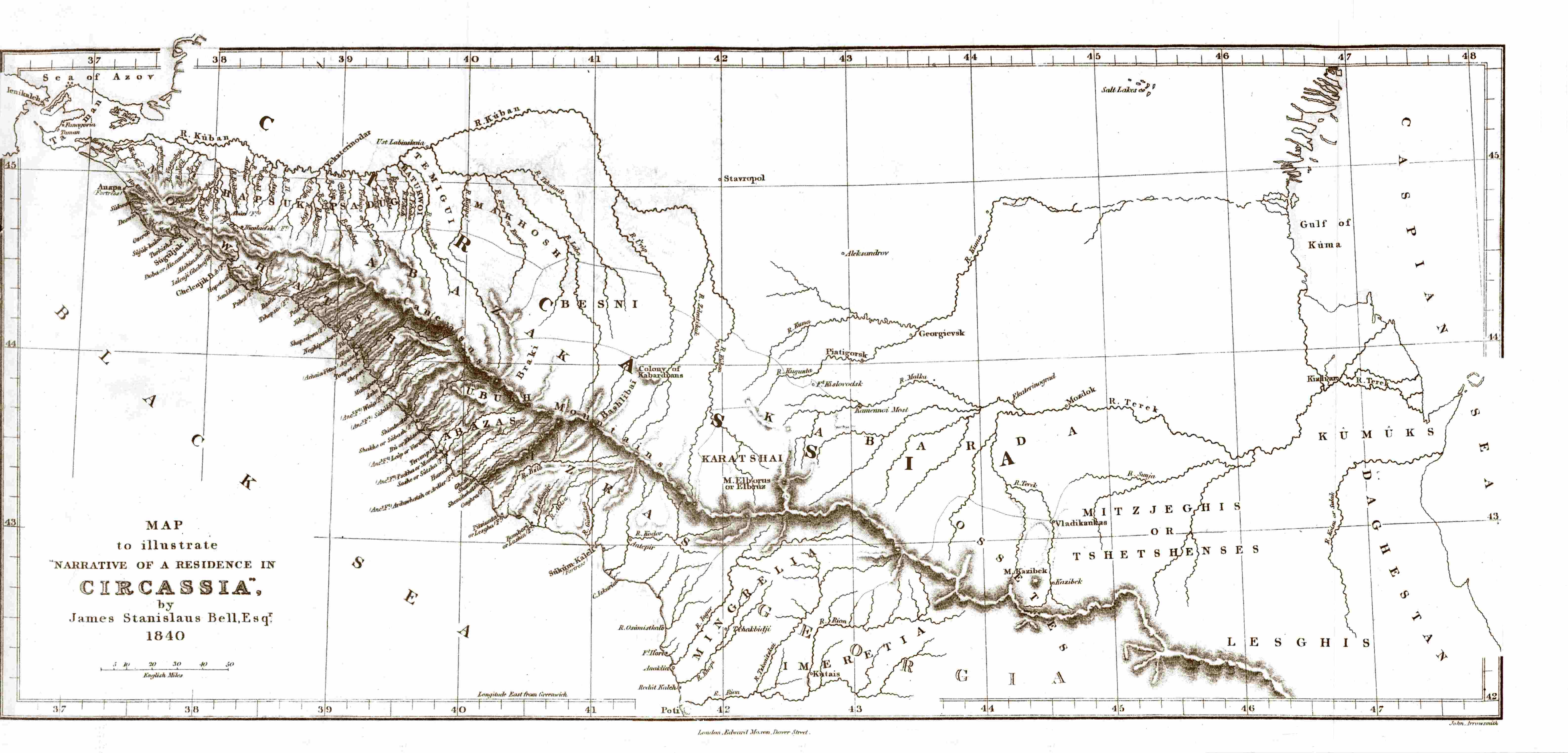
| Description | Map of Circassia, made in 1840 during the en:Russian-Circassian War , PD due to author's death over 100 years ago. Found here , lon. 36.5° - 48° E, lat. 42° - 45.5° N | ||||
| Date | 5 May 2007 (original upload date) | ||||
| Source | Transferred from en.wikipedia to Commons. | ||||
| Author |
James Stanislaus Bell (1797-1858) |
||||
|
Permission
( Reusing this file ) |
|
||||
Original upload log
- 2007-05-05 20:44 SGGH 6348×3047×8 (556561 bytes) Map of Circassia, made in 1840 during the [[Russian-Circassian War]], PD due to author's death over 100 years ago. Found [http://www.circassianworld.com/CIRCASSIA1840.jpg here]