Cabinda_pol77.jpg

Size of this preview:
455 × 599 pixels
.
Other resolutions:
182 × 240 pixels
|
364 × 480 pixels
|
583 × 768 pixels
|
1,040 × 1,370 pixels
.

|
File:Cabinda map-fr.svg
is a vector version of this file. It should be used in place of this JPG file when not inferior.
File:Cabinda pol77.jpg →
File:Cabinda map-fr.svg
For more information, see
Help:SVG
.
|

|
Summary
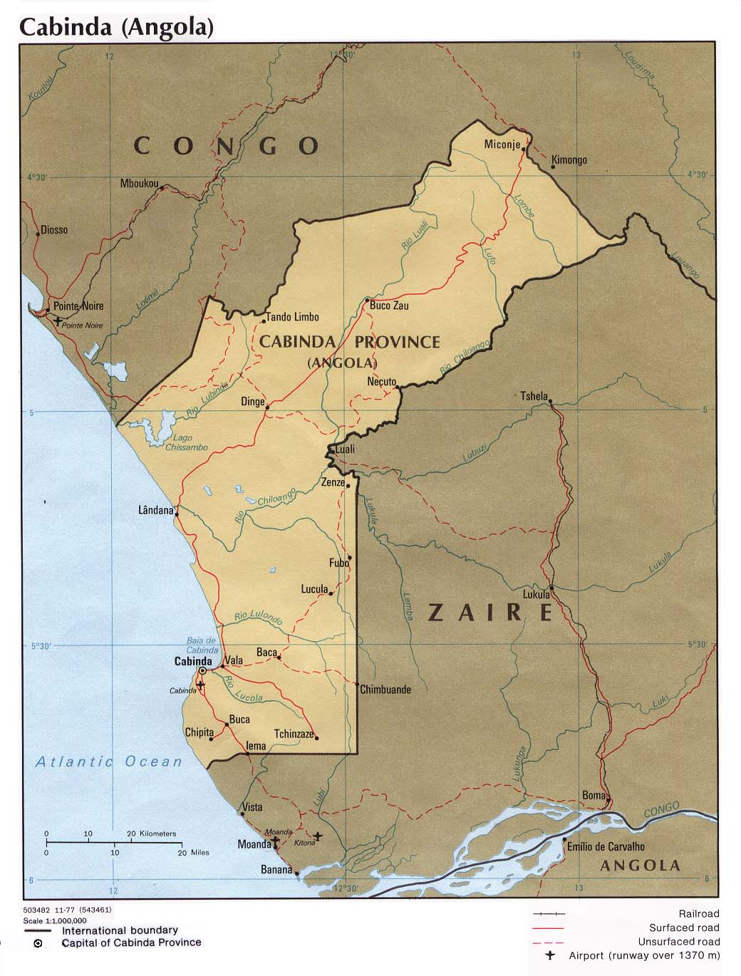
| Description | Political map of the Cabinda province, Angola. |
| Date | |
| Source | University of Texas Libraries, Perry-Castañeda Library Map Collection: Angola Maps |
| Author | CIA |
| Other versions | Derivative works of this file: Cabinda map-fr.svg |
Licensing
|
|
This image is a work of a
Central Intelligence Agency
employee, taken or made as part of that person's official duties. As a Work of the United States Government, this image or media is in the
public domain
in the United States.
|

|