California_US_Congressional_District_12_(since_2013).tif
Size of this PNG preview of this TIF file:
800 × 394 pixels
.
Other resolutions:
320 × 158 pixels
|
640 × 316 pixels
|
1,024 × 505 pixels
|
2,016 × 994 pixels
.
Summary
| Description |
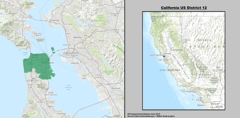
English:
Boundaries for
California's 12th US Federal Congressional District
— in San Francisco.
|
| Date | |
| Source | GIS shapefile data created by the United States Department of the Interior, as part of the "1 Million Scale" geospatial data project. Retrieved from: http://nationalatlas.gov/atlasftp-1m.html?openChapters=#chpbound |
| Author | 1: GIS (congressional districts, 2013) shapefile data was created by the United States Department of the Interior. 2: Data was rendered using ArcGIS® software by Esri. 3: File developed for use on Wikipedia and elsewhere by 7partparadigm . |
Licensing
|
|
This map was obtained from an edition of the
National Atlas of the United States
. Like almost all works of the U.S. federal government, works from the
National Atlas
are in the
public domain
in the United States.
Online access: NationalAtlas.gov | 1970 print edition: Library of Congress , Perry-Castañeda Library
|
|
en:California's 12th congressional district