Cardington_station_(remains)_geograph-3128277-by-Ben-Brooksbank.jpg
Size of this preview:
800 × 416 pixels
.
Other resolutions:
320 × 167 pixels
|
640 × 333 pixels
|
1,024 × 533 pixels
|
1,280 × 666 pixels
|
2,394 × 1,246 pixels
.
Summary
| Description |
English:
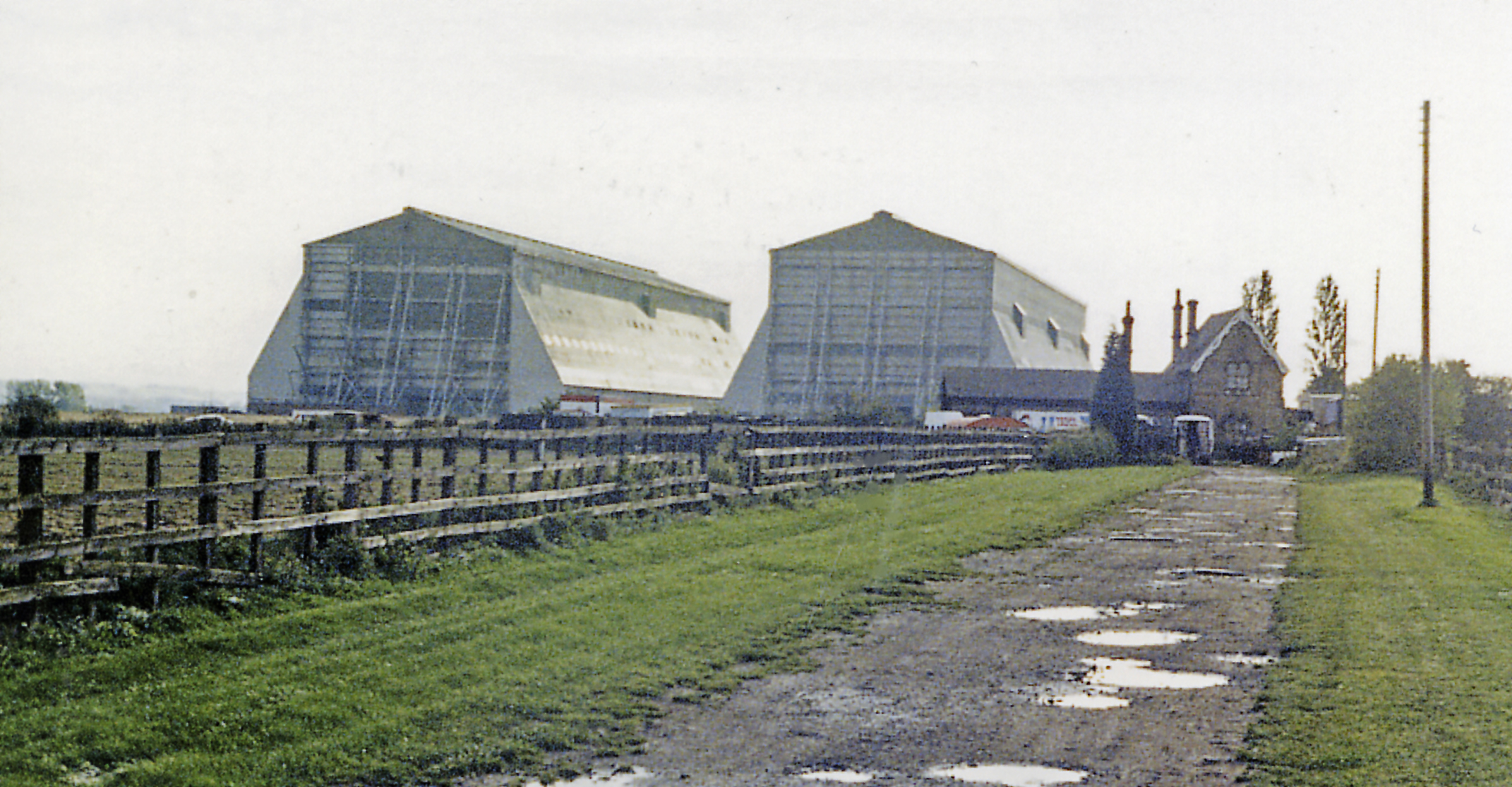
Cardington station (remains) and Airship Sheds, 1987.
View SW, across the former ex-Midland Bedford (right) - Hitchin (left) line. The line was closed to passengers from 1/1/62, but may have remained open for goods until 1969. The station seems to be well preserved, still overshadowed by the Airship Sheds. |
| Date | |
| Source | From geograph.org.uk |
| Author | Ben Brooksbank |
|
Permission
( Reusing this file ) |
Creative Commons Attribution Share-alike license 2.0 |
|
Attribution
( required by the license ) |
Ben Brooksbank / Cardington station (remains) and Airship Sheds, 1987 / |
| Camera location |
|
View this and other nearby images on: OpenStreetMap |
|
|---|
_geograph-3128277-by-Ben-Brooksbank.jpg¶ms=052.114039_N_-000.418521_E_globe:Earth_type:camera_heading:225.00&language=en)
Licensing

|
This image was taken from the
Geograph project
collection. See
this photograph's page
on the Geograph website for the photographer's contact details. The copyright on this image is owned by
Ben Brooksbank
and is licensed for reuse under the
Creative Commons
Attribution-ShareAlike 2.0 license.
|
This file is licensed under the
Creative Commons
Attribution-Share Alike 2.0 Generic
license.
Attribution:
Ben Brooksbank
-
You are free:
- to share – to copy, distribute and transmit the work
- to remix – to adapt the work
-
Under the following conditions:
- attribution – You must give appropriate credit, provide a link to the license, and indicate if changes were made. You may do so in any reasonable manner, but not in any way that suggests the licensor endorses you or your use.
- share alike – If you remix, transform, or build upon the material, you must distribute your contributions under the same or compatible license as the original.