Carsebreck_Loch_and_Upper_Rhynd,_near_Braco_-_geograph.org.uk_-_63549.jpg
No higher resolution available.
Summary
| Description |
English:
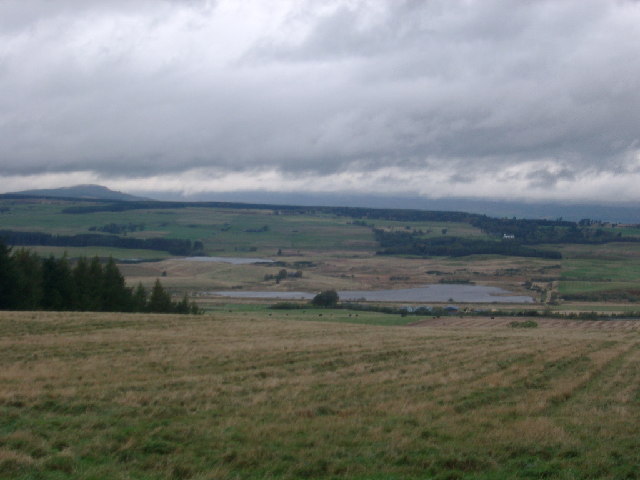
Carsebreck Loch & Upper Rhynd, near Braco. Farm buildings are Netherton Farm. The A9 and the Stirling Inverness railway run this side of the loch. The land beyond the lochs was occupied by the Romans - part of the most northerly Roman frontier in Europe, along the Gask range. Just beyond the rise behind the far loch is the remains of a Roman road.
|
| Date | |
| Source | From geograph.org.uk |
| Author | Kirsty Smith |
|
Attribution
( required by the license ) |
Kirsty Smith / Carsebreck Loch & Upper Rhynd, near Braco / |
| Camera location |
|
View this and other nearby images on: OpenStreetMap |
|
|---|
_heading:0.00&language=en)
| Object location |
|
View this and other nearby images on: OpenStreetMap |
|
|---|
_heading:0.00&language=en)
Licensing

|
This image was taken from the
Geograph project
collection. See
this photograph's page
on the Geograph website for the photographer's contact details. The copyright on this image is owned by
Kirsty Smith
and is licensed for reuse under the
Creative Commons
Attribution-ShareAlike 2.0 license.
|
This file is licensed under the
Creative Commons
Attribution-Share Alike 2.0 Generic
license.
Attribution:
Kirsty Smith
-
You are free:
- to share – to copy, distribute and transmit the work
- to remix – to adapt the work
-
Under the following conditions:
- attribution – You must give appropriate credit, provide a link to the license, and indicate if changes were made. You may do so in any reasonable manner, but not in any way that suggests the licensor endorses you or your use.
- share alike – If you remix, transform, or build upon the material, you must distribute your contributions under the same or compatible license as the original.