Carte_physique_et_politique_de_la_syrie_pour_servir_a_l'histoire_des_conquetes_du_general_Bonaparte_en_Orient.jpg

Summary
| Description |
English:
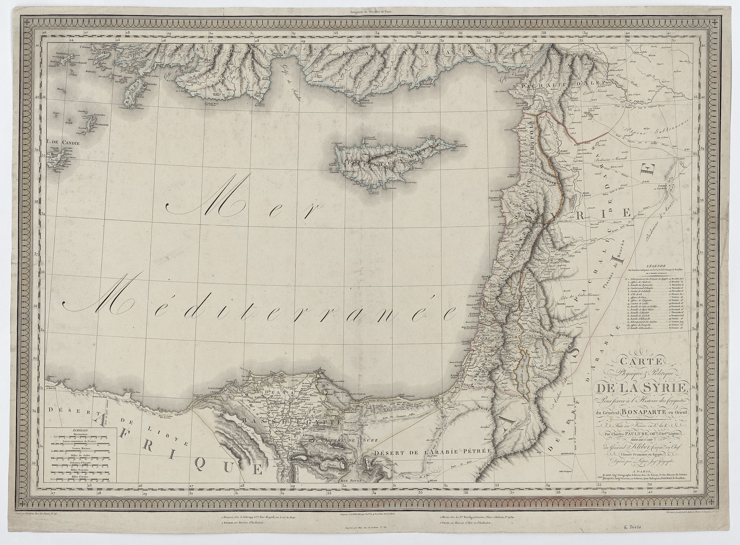
Carte Physique & Politique de la Syrie : Pour servir à l'Histoire des Conquêtes du Général Bonaparte en Orient. Faite au Kaire en l'An 8 COLLBN Port 174 N 148
|
| Date | |
| Source | Charles Paultre; Alexandre Émile Lapie; Lapie, M.; Blondeau |
| Author | Charles Paultre; Alexandre Émile Lapie; Lapie, M.; Blondeau |
Licensing
|
This image is in the
public domain
because it is a mere mechanical scan or photocopy of a public domain original, or – from the available evidence – is so similar to such a scan or photocopy that no copyright protection can be expected to arise. The original itself is in the public domain for the following reason:
This tag is designed for use where there may be a need to assert that any enhancements (eg brightness, contrast, colour-matching, sharpening) are in themselves insufficiently creative to generate a new copyright. It can be used where it is unknown whether any enhancements have been made, as well as when the enhancements are clear but insufficient. For known raw unenhanced scans you can use an appropriate {{PD-old}} tag instead. For usage, see Commons:When to use the PD-scan tag . 
|
||||