Cederberg_LM_topographic_map.svg

Size of this PNG preview of this SVG file:
614 × 600 pixels
.
Other resolutions:
246 × 240 pixels
|
491 × 480 pixels
|
786 × 768 pixels
|
1,049 × 1,024 pixels
|
2,097 × 2,048 pixels
|
1,113 × 1,087 pixels
.
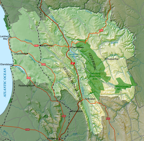
Summary
| Description |
English:
Topographic map of the
Cederberg Local Municipality
in South Africa.
|
|||
| Date | ||||
| Source | Own work | |||
| Author | Htonl | |||
|
Permission
( Reusing this file ) |
I, the copyright holder of this work, hereby publish it under the following licenses:
This file is licensed under the
Creative Commons
Attribution-Share Alike 4.0 International
license.
This file is licensed under the
Creative Commons
Attribution-Share Alike 3.0 Unported
license.
You may select the license of your choice.
|
|||
| SVG development |
|