Cedid_Atlas_Title_Page.jpg
Size of this preview:
447 × 600 pixels
.
Other resolutions:
179 × 240 pixels
|
358 × 480 pixels
|
572 × 768 pixels
|
763 × 1,024 pixels
|
1,431 × 1,920 pixels
.
Summary
| Description |
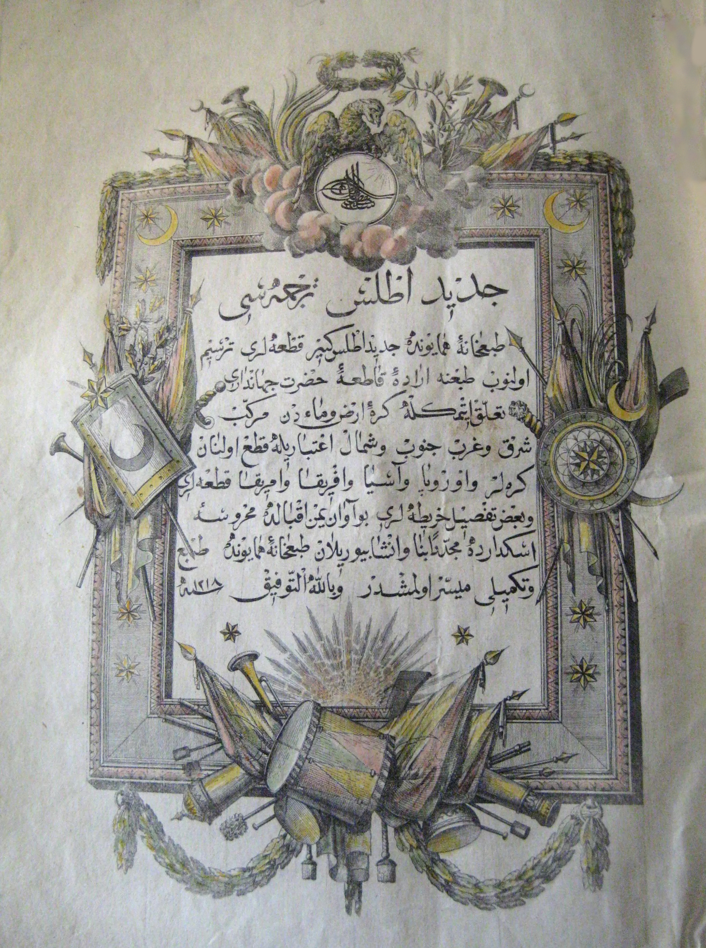
العربية:
مُقدِّمة الأطلس الجديد، أوَّل الأطالس الجغرافيَّة الحديثة المنشورة في الدولة العُثمانيَّة والعالم الإسلامي.
English:
Cedid Atlas Title Page, the first modern Atlas to be published in the Ottoman Empire and the Muslim World.
|
| Date | |
| Source | Original source |
| Author | Mühendishane Matbaası (publisher) |
| Description |
|
||||||||||||||||||||
| Medium | drawing mounted on paper | ||||||||||||||||||||
| Dimensions | height: 36 cm (14.1 in); width: 53 cm (20.8 in) | ||||||||||||||||||||
| Place of creation | Üsküdar | ||||||||||||||||||||
| Source/Photographer |
|
||||||||||||||||||||


Licensing
|
|
This work first published in the
Ottoman Empire
is now in the
public domain
because the Empire's copyright formalities were not met (copyright notice, registration, and deposit), or because the copyright term (30 years after the death of the author, sometimes less) expired before the Empire was dissolved (
details
).
|
.svg)
|