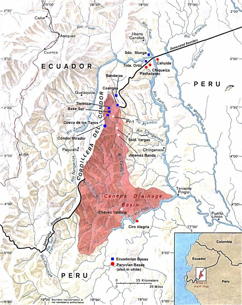
Cenepa_river_basin.jpg
Size of this preview:
476 × 600 pixels
.
Other resolutions:
190 × 240 pixels
|
381 × 480 pixels
|
965 × 1,216 pixels
.
Summary
| Description |
English:
Peru-Ecuador (Area of Boundary Dispute).
|
| Date | Unknown date |
| Source | |
| Author | The University of Texas at Austin |
|
Permission
( Reusing this file ) |
Stated as public domain. |
Licensing
|
|
This work is based on a work in the
public domain
. It has been digitally enhanced and/or modified. This derivative work has been (or is hereby) released into the
public domain
by its author,
Andres C.
. This applies worldwide.
In some countries this may not be legally possible; if so:
|
Original upload log
The original description page was
here
. All following user names refer to en.wikipedia.
- 2010-10-30 14:30 Beao 965×1216× (921862 bytes)
- 2009-10-01 21:16 Andres C. 1000×1292× (876675 bytes) A retouched image of a map located online at the University of Texas Library - PCL Map Collection website. Stated as public domain: http://www.lib.utexas.edu/maps/americas/peru_ecuador_81.jpg "Courtesy of the University of Texas Libraries, The Universit