CentervilleBeachCrossCliff.jpg

Size of this preview:
800 × 600 pixels
.
Other resolutions:
320 × 240 pixels
|
640 × 480 pixels
|
1,024 × 768 pixels
|
1,280 × 960 pixels
|
2,560 × 1,920 pixels
|
3,072 × 2,304 pixels
.
Summary
| Description |
English:
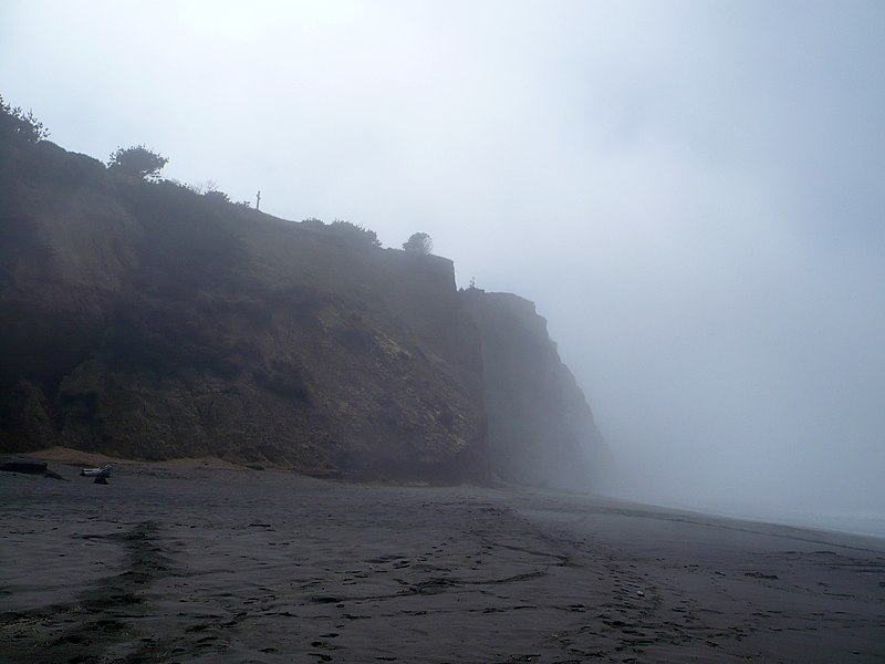
Centerville Beach Cross marks the location of the loss of the SS Northerner. In 1921, the Ferndale Parlor of the Native Sons of the Golden West placed a cross and marker on the hill overlooking Centerville Beach. The first marker was destroyed in the 1992 Cape Mendocino earthquakes. A new marker was placed and rededicated on February 11, 1995. The only approach is up an ATV trail on a nearly vertical cliff. California Historical Landmark Reference #173
|
||
| Date | |||
| Source | Own work | ||
| Author | Ellin Beltz | ||
|
Permission
( Reusing this file ) |
|

|
This image was uploaded as part of
Wiki Loves Monuments 2012
.
|

|
| Camera location |
|
View this and other nearby images on: OpenStreetMap |
|
|---|