Centro_de_flores_(Porcelana_Buen_Retiro,_MAN_1982-85-5)_01.jpg
Size of this preview:
601 × 600 pixels
.
Other resolutions:
241 × 240 pixels
|
481 × 480 pixels
|
770 × 768 pixels
|
1,026 × 1,024 pixels
|
2,230 × 2,225 pixels
.
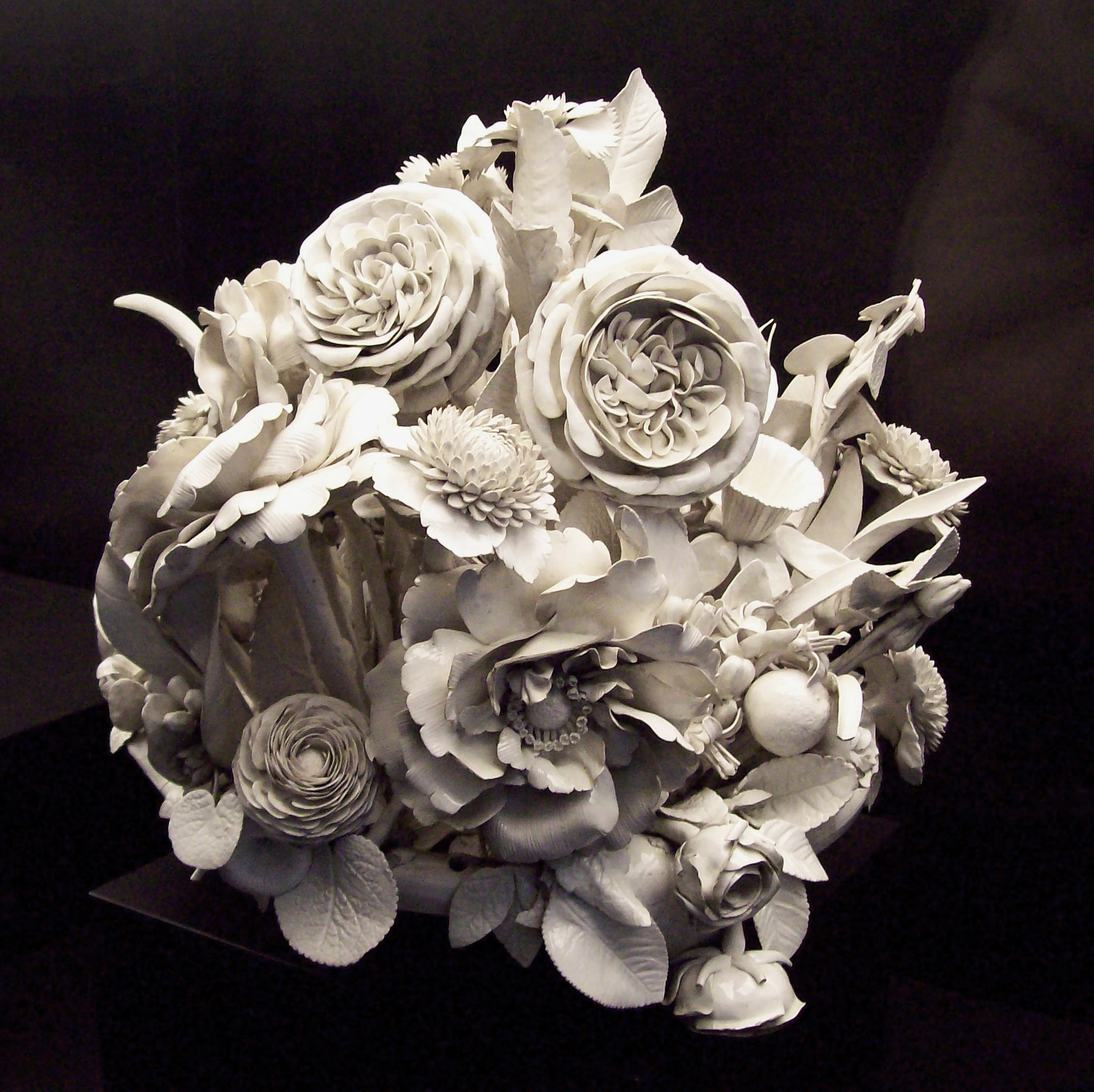
| Artist |
Bautista family
|
|||||||||||||||||||||||
| Description | ||||||||||||||||||||||||
| Date | between 1760 and 1784 | |||||||||||||||||||||||
| Medium | porcelain | |||||||||||||||||||||||
| Dimensions | length: 44 cm (17.3 in); height: 37 cm (14.5 in) | |||||||||||||||||||||||
| Collection |
|
|||||||||||||||||||||||
| Accession number |
1982/85/5
|
|||||||||||||||||||||||
| Object history | place of creation: Buen Retiro Royal Porcelain Factory ( Madrid , Spain ). | |||||||||||||||||||||||
| References | Museum's website – Web del museo – Site du musée | |||||||||||||||||||||||
| Source/Photographer | Luis García ( Zaqarbal ), 3 December 2008. | |||||||||||||||||||||||
|
Permission
( Reusing this file ) |
I, the copyright holder of this work, hereby publish it under the following licenses:
This file is licensed under the
Creative Commons
Attribution-Share Alike
3.0 Unported
,
2.5 Generic
,
2.0 Generic
and
1.0 Generic
license.
Attribution:
Luis García
You may select the license of your choice.
|
|||||||||||||||||||||||
| Other versions |
_02.jpg)
|
|||||||||||||||||||||||


| Camera location |
|
View this and other nearby images on: OpenStreetMap |
|
|---|
_01.jpg¶ms=040.423355_N_-003.688779_E_globe:Earth_type:camera__&language=en)