Cessetani_location_map-blank.svg

Size of this PNG preview of this SVG file:
800 × 600 pixels
.
Other resolutions:
320 × 240 pixels
|
640 × 480 pixels
|
1,024 × 768 pixels
|
1,280 × 960 pixels
|
2,560 × 1,920 pixels
|
1,140 × 855 pixels
.
Summary
| Description |
English
:
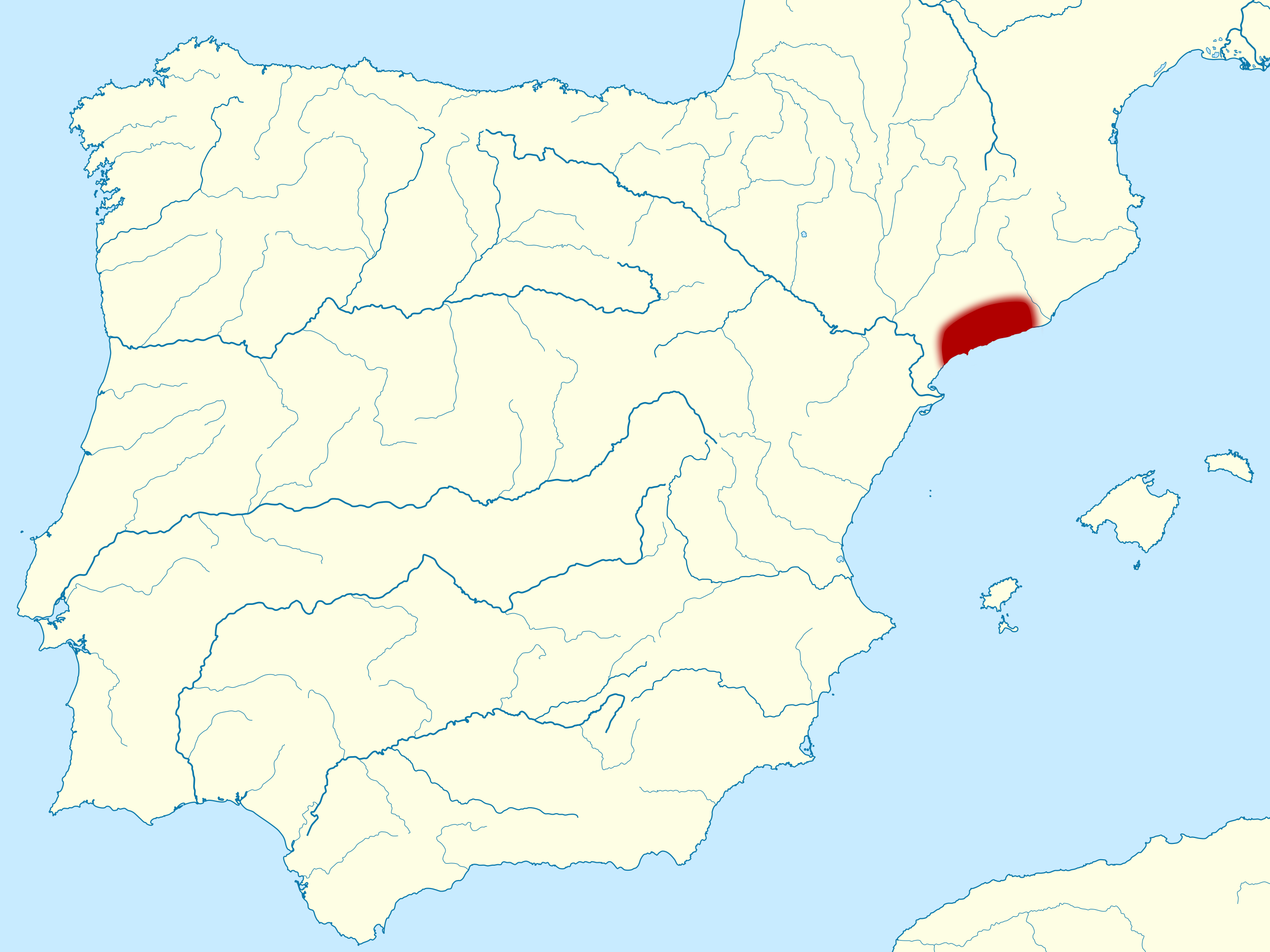
Location map of the pre-Roman people of
Cessetani
in Iberian peninsula, along the coast between the Coll de Balaguer and the Garraf Massif, and limited in the west by the Prades Mountains.
Français
:
Carte de localisation du peuple
Cessetani
dans la péninsule Ibérique. Ce peuple vivait avant la conquête romaine le long de la côte entre le Col de Balaguer au sud, jusqu'au Massif de Garraf au nord, la sierra d'Argentera et les montagnes de Prades à l'ouest, et la sierra de la Llacuna et de Puigfred au nord-ouest.
|
| Date | (UTC) |
| Source | |
| Author |
|
|
Attribution
( required by the license ) |
© Sémhur / Wikimedia Commons / |
| Camera location |
|
View this and other nearby images on: OpenStreetMap |
|
|---|
W3C-validity not checked.
This
W3C-unspecified
vector image
was created with
Inkscape
.
Licensing
I, the copyright holder of this work, hereby publish it under the following licenses:
|
|
Copyleft: This work of art is free; you can redistribute it and/or modify it according to terms of the Free Art License . You will find a specimen of this license on the Copyleft Attitude site as well as on other sites . |
This file is licensed under the
Creative Commons
Attribution-Share Alike
4.0 International
,
3.0 Unported
,
2.5 Generic
,
2.0 Generic
and
1.0 Generic
license.
-
You are free:
- to share – to copy, distribute and transmit the work
- to remix – to adapt the work
-
Under the following conditions:
- attribution – You must give appropriate credit, provide a link to the license, and indicate if changes were made. You may do so in any reasonable manner, but not in any way that suggests the licensor endorses you or your use.
- share alike – If you remix, transform, or build upon the material, you must distribute your contributions under the same or compatible license as the original.
You may select the license of your choice.
Original upload log
This image is a derivative work of the following images:
-
File:Catiberica.svg
licensed with PD-self
- 2007-07-12T23:51:52Z HansenBCN 887x902 (463187 Bytes) {{Information |Description= Pre-Roman peoples in Catalonia, boundaries map |Source= Own map |Date= July 13th 2007 |Author= Hansen |Permission= }} [[Category:History of Catalonia]]
- 2007-07-12T23:34:57Z HansenBCN 2500x2542 (474751 Bytes) {{Information |Description=Pre-Roman peoples in Catalonia |Source= |Date= |Author= Hansen |Permission= |other_versions= }} [[Category:History of Catalonia]]
-
File:Via_Augusta_map-fr.svg
licensed with Cc-by-sa-3.0,2.5,2.0,1.0, FAL
- 2011-07-27T08:12:03Z Sémhur 1261x1051 (567874 Bytes)
Uploaded with derivativeFX