Chad-Niger_boundary._LOC_85697523.jpg
Size of this preview:
454 × 599 pixels
.
Other resolutions:
182 × 240 pixels
|
364 × 480 pixels
|
582 × 768 pixels
|
776 × 1,024 pixels
|
1,552 × 2,048 pixels
|
3,164 × 4,176 pixels
.
Summary
| Description |
English:
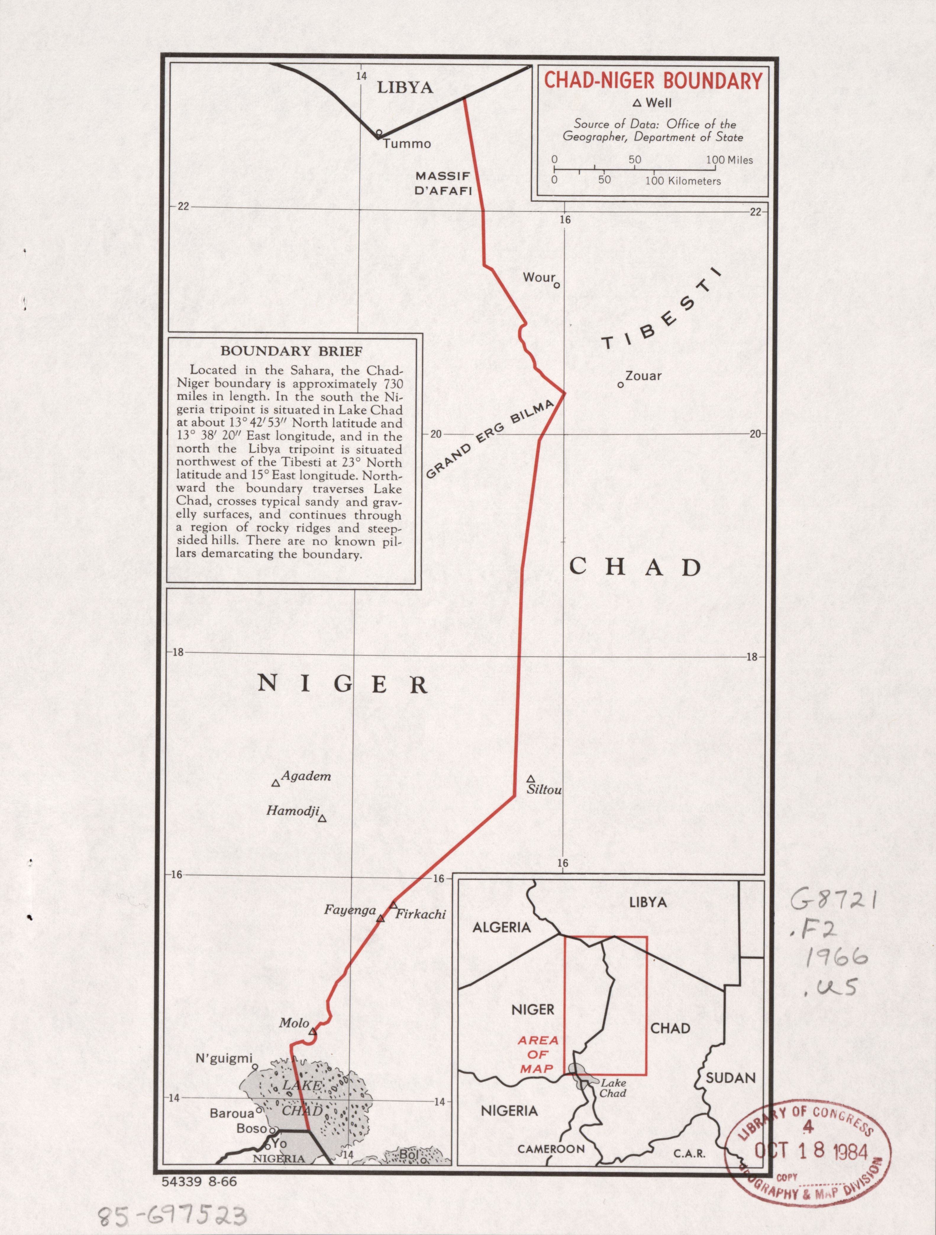
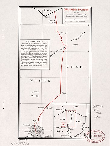
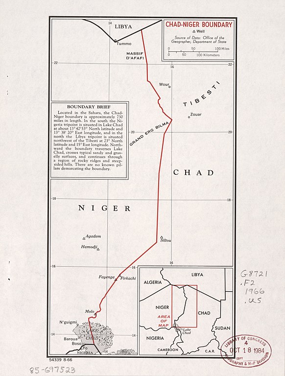
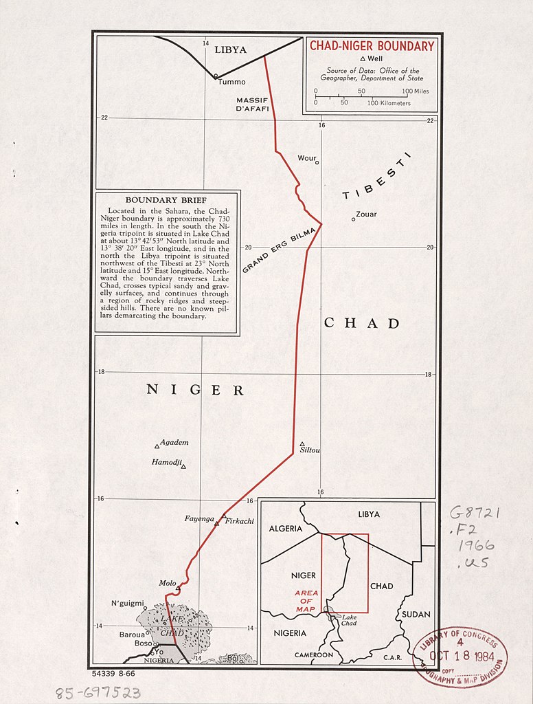
"54339 8-66." Also shows wells. "Source of data: Office of the Geographer, Department of State." Includes note and key map. Available also through the Library of Congress Web site as a raster image.
|
||
| Title | Chad-Niger boundary. | ||
| Shelf ID | G8721.F2 1966 .U5 | ||
| Date | |||
| Source | https://www.loc.gov/item/85697523/ | ||
| Author | United States. Central Intelligence Agency; United States. Department Of State. Office Of The Geographer | ||
|
Permission
( Reusing this file ) |
|
||
| Other versions |
|
||
| Location | Niger · Chad | ||
| Part of | American Memory · General Maps · Catalog · Geography And Map Division | ||
| Subject | Boundaries · Maps · Niger · Chad |

Licensing
|
|
This image is a work of a
Central Intelligence Agency
employee, taken or made as part of that person's official duties. As a Work of the United States Government, this image or media is in the
public domain
in the United States.
|

|