Chain_home_coverage.jpg
Size of this preview:
366 × 599 pixels
.
Other resolutions:
146 × 240 pixels
|
293 × 480 pixels
|
640 × 1,048 pixels
.
| Description |
English:
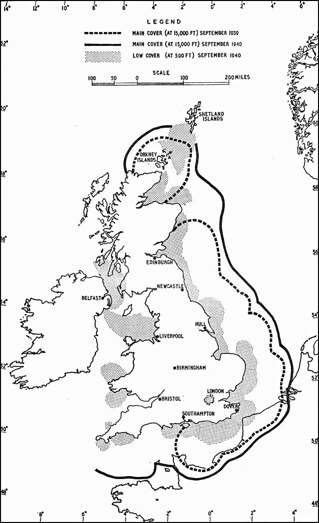
RADAR COVER, SEPTEMBER 1939 AND SEPTEMBER 1940
|
|||
| Date | ||||
| Source | http://www.ibiblio.org | |||
| Author | British Official Histories (History of the Second World War) | |||
|
Permission
( Reusing this file ) |
|
|||
| Other versions |


|


|
This
historical map
image could be re-created
using
vector graphics
as an
SVG
file
. This has several advantages; see
Commons:Media for cleanup
for more information. If an SVG form of this image is available, please upload it and afterwards replace this template with
{{

vector version available

|

new image name

}}
.
It is recommended to name the SVG file “Chain home coverage.svg”—then the template Vector version available (or Vva ) does not need the new image name parameter. |

