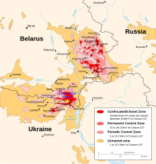
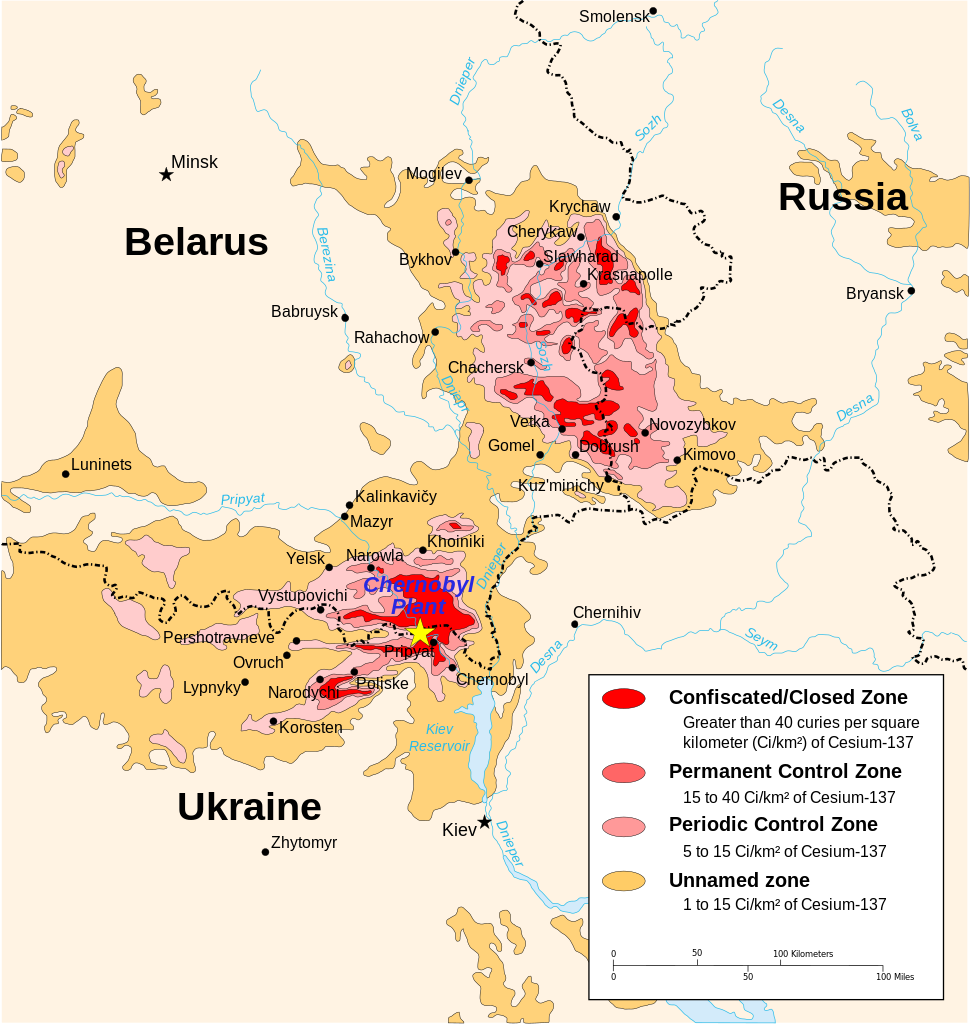
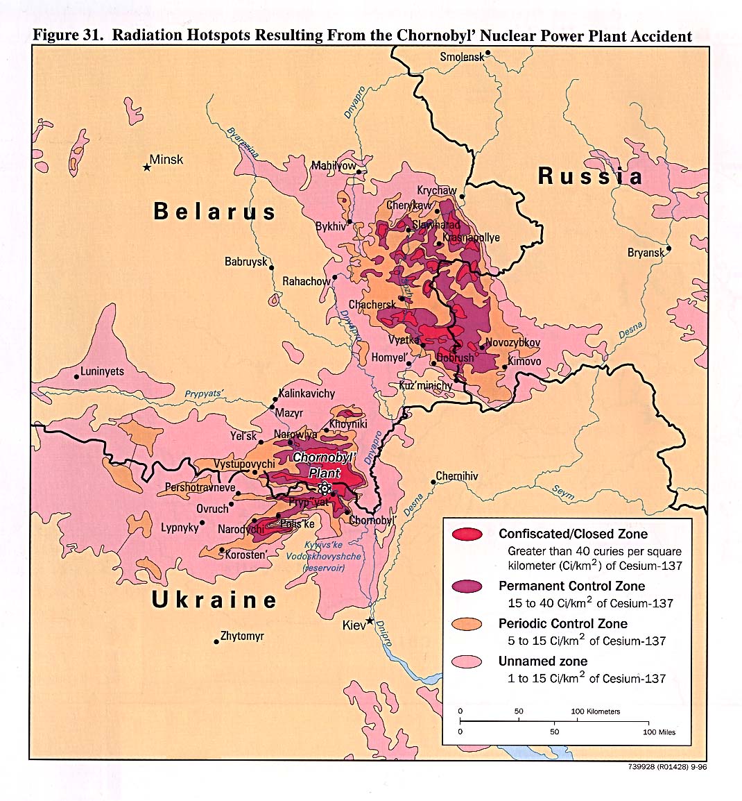
Chernobyl_radiation_map_1996.svg

Size of this PNG preview of this SVG file:
568 × 600 pixels
.
Other resolutions:
227 × 240 pixels
|
455 × 480 pixels
|
727 × 768 pixels
|
970 × 1,024 pixels
|
1,940 × 2,048 pixels
|
1,398 × 1,476 pixels
.
| Description |
English:
Chernobyl radiation map from CIA handbook, svg'd by
User:Sting
, and re-anglified by me (to the same strange names used in the original).
|
| Source | http://www.lib.utexas.edu/maps/belarus.html , specifically http://www.lib.utexas.edu/maps/commonwealth/chornobyl_radiation96.jpg and File:Tchernobyl_radiation_1996.svg for the vector version |
| Author | CIA Factbook, Sting (vectorisation), MTruch (English translation), Makeemlighter (English translation) |
|
Permission
( Reusing this file ) |
This file is licensed under the
Creative Commons
Attribution-Share Alike 2.5 Generic
license.
|
| Other versions |
Derivative works of this file:
[
]
|


.svg)


|