China_linguistic_map.jpg
Size of this preview:
515 × 599 pixels
.
Other resolutions:
206 × 240 pixels
|
412 × 480 pixels
|
660 × 768 pixels
|
880 × 1,024 pixels
|
1,760 × 2,048 pixels
|
2,640 × 3,072 pixels
.

Summary
| Description |
English:
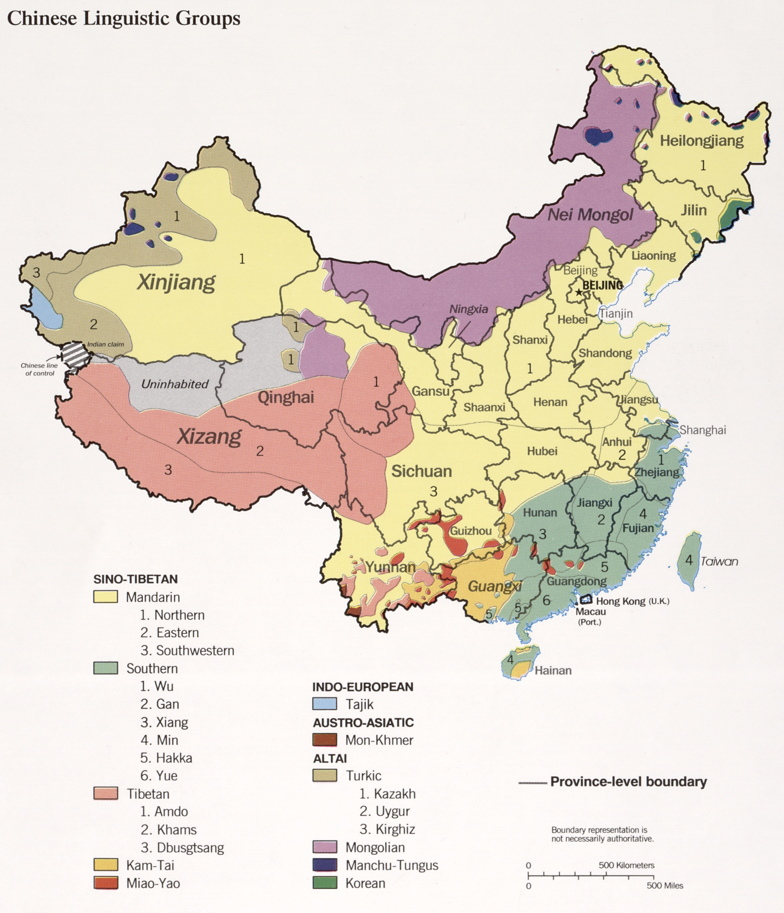
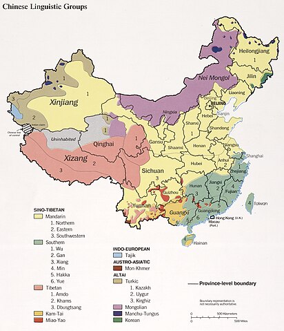
Chinese linguistic groups
, 1990. The map shows the distribution of linguistic groups in China according to the historical majority ethnic groups by region. Note this does not represent the current distribution due to age-long internal migration and assimilation.
|
| Date | |
| Source |
|
| Author | U.S. Central Intelligence Agency |
| Other versions |
|


Licensing
|
|
This image is a work of a
Central Intelligence Agency
employee, taken or made as part of that person's official duties. As a Work of the United States Government, this image or media is in the
public domain
in the United States.
|

|
Original upload log
The original description page was
here
. All following user names refer to en.wikipedia.
- 2004-03-02 10:12 Jiang 900×1131× (200611 bytes) Source: Central Intelligence Agency 1990.