Christiania_depuis_Notre_Sauveur.jpg
Size of this preview:
397 × 599 pixels
.
Other resolutions:
159 × 240 pixels
|
318 × 480 pixels
|
508 × 768 pixels
|
678 × 1,024 pixels
|
1,356 × 2,048 pixels
|
3,608 × 5,448 pixels
.
Summary
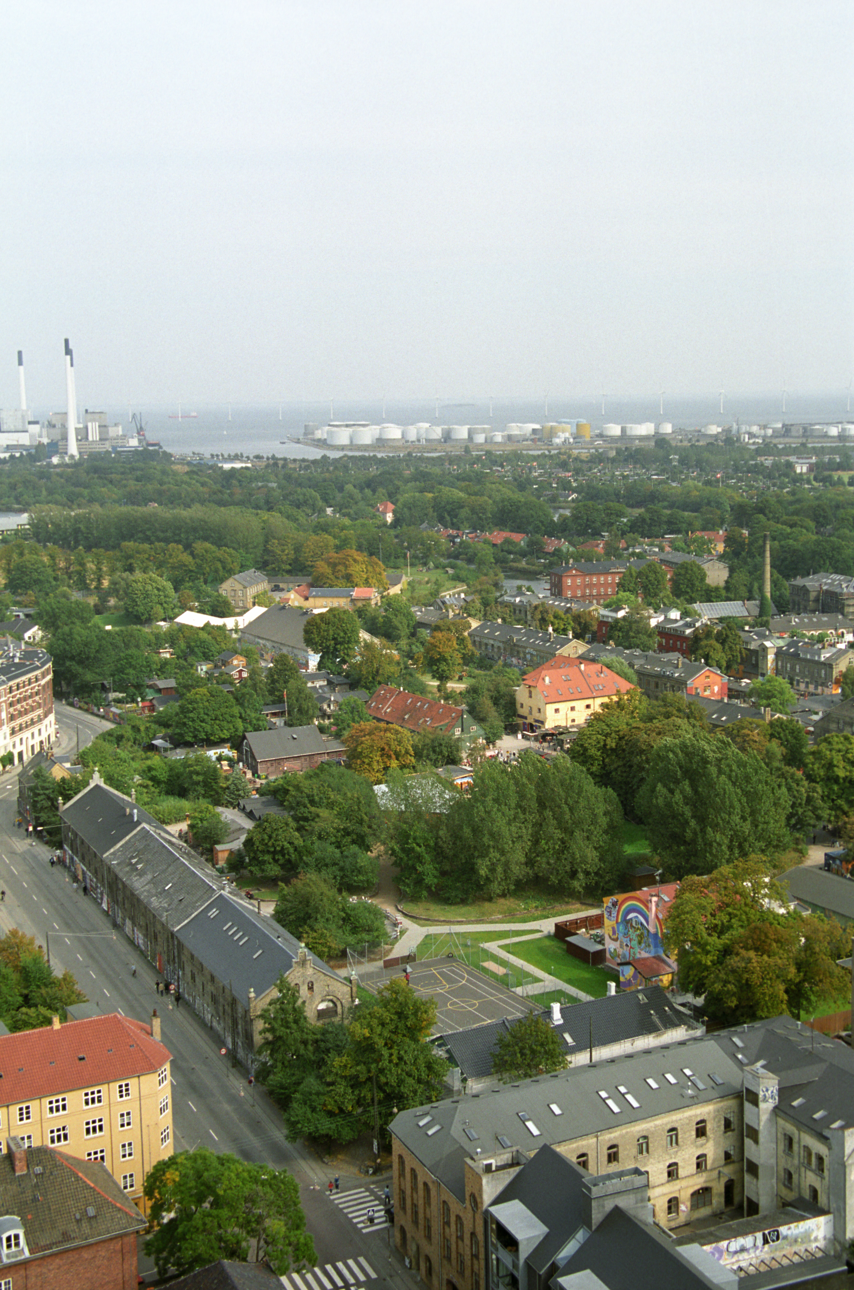
| Description | The street in the foreground is Prinsessegade, crossing Bådsmandssræde in the bottom of the picture. In the horizon is three chimneys at da:Amagerforbrænding and Amagerværket. The oil tanks at Prøvestenen are visible. The water area is en:Øresund with en:Sweden hardly visible. The main object, of course, is Christiania in the center. |
| Date | |
| Source | Uploaded by the author |
| Author | Bruno Jargot |
| Camera location |
|
View this and other nearby images on: OpenStreetMap |
|
|---|
Licensing
Image from Bruno Jargot : http://errance.lirano.net/ archive copy at the Wayback Machine taken in september 2003.
I, the copyright holder of this work, hereby publish it under the following license:
This file is licensed under the
Creative Commons
Attribution-Share Alike 2.5 Generic
license.
-
You are free:
- to share – to copy, distribute and transmit the work
- to remix – to adapt the work
-
Under the following conditions:
- attribution – You must give appropriate credit, provide a link to the license, and indicate if changes were made. You may do so in any reasonable manner, but not in any way that suggests the licensor endorses you or your use.
- share alike – If you remix, transform, or build upon the material, you must distribute your contributions under the same or compatible license as the original.