CircumnavigationByCapes.png
No higher resolution available.
Summary
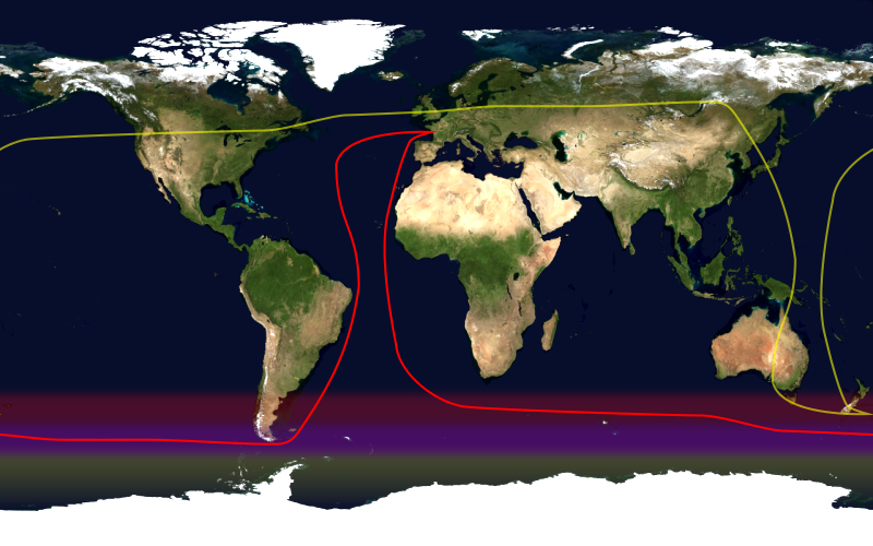
This image shows the route, in red, of a typical round-the-world yacht race via the great capes , by way of the roaring forties . Shown in yellow is the antipodean point of each point on the route; it can be seen that a boat following this route will not pass through any pair of antipodal points. Since doing so in the context of a race — particularly a non-stop race — would be impractical, yacht racing uses a different definition of a circumnavigation.
This image was constructed from a public domain Visible Earth product of the Earth Observatory office of the United States government space agency NASA . It is based on a cylindrical equi-distant projection .
Licensing
|
|
This file is in the public domain in the United States because it was solely created by NASA . NASA copyright policy states that "NASA material is not protected by copyright unless noted ". (See Template:PD-USGov , NASA copyright policy page or JPL Image Use Policy .) |
|

|
Warnings:
|