Civita_(Çifti)_(CS),_Le_Vallje_2009._(5).jpg
No higher resolution available.
Summary
| Description |
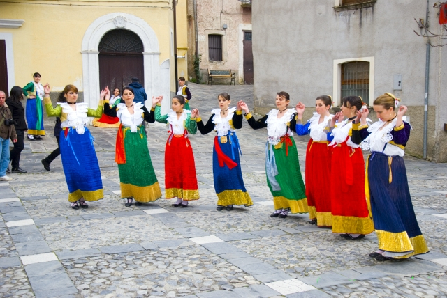
Le vallje sono danze e canti con cui gli albanesi di Calabria rievocano le gesta dell'eroe albanese Giorgio Castriota Scanderbeg. I canti sono di solito cori accompagnati da più strumenti musicali. Il ballo, la vallja, è costituita da una "catena" di Arbëreshë che si tengono per mano o legati da un fazzoletto colorato, cantano e ballano. La vallja si sposta sempre, come un drappello di soldati in battaglia. I balli si snodano nelle vie del paese e terminano nella "piazza delle vallje".
|
| Date | |
| Source |
Civita (Çifti) (CS), Le Vallje 2009.
|
| Author | Fiore Silvestro Barbato from Napoli (NA), Italy |
| Camera location |
|
View this and other nearby images on: OpenStreetMap |
|
|---|
_(CS),_Le_Vallje_2009._(5).jpg¶ms=039.827547_N_0016.313259_E_globe:Earth_type:camera_source:Flickr_&language=en)
Licensing
This file is licensed under the
Creative Commons
Attribution-Share Alike 2.0 Generic
license.
-
You are free:
- to share – to copy, distribute and transmit the work
- to remix – to adapt the work
-
Under the following conditions:
- attribution – You must give appropriate credit, provide a link to the license, and indicate if changes were made. You may do so in any reasonable manner, but not in any way that suggests the licensor endorses you or your use.
- share alike – If you remix, transform, or build upon the material, you must distribute your contributions under the same or compatible license as the original.
|
|
This image, originally posted to Flickr , was reviewed on November 20, 2011 by the administrator or reviewer File Upload Bot (Magnus Manske) , who confirmed that it was available on Flickr under the stated license on that date. |

|
Attribution information, such as the author's name, e-mail, website, or signature, that was once visible in the image itself has been
moved into the image metadata and/or image description page
. This makes the image easier to reuse and more language-neutral, and makes the text easier to process and search for. Commons
discourages
placing visible author information in images.
|