Colonial_empires_in_1800.svg

Size of this PNG preview of this SVG file:
800 × 351 pixels
.
Other resolutions:
320 × 140 pixels
|
640 × 281 pixels
|
1,024 × 449 pixels
|
1,280 × 561 pixels
|
2,560 × 1,123 pixels
|
1,425 × 625 pixels
.
Summary
| Description |
English:
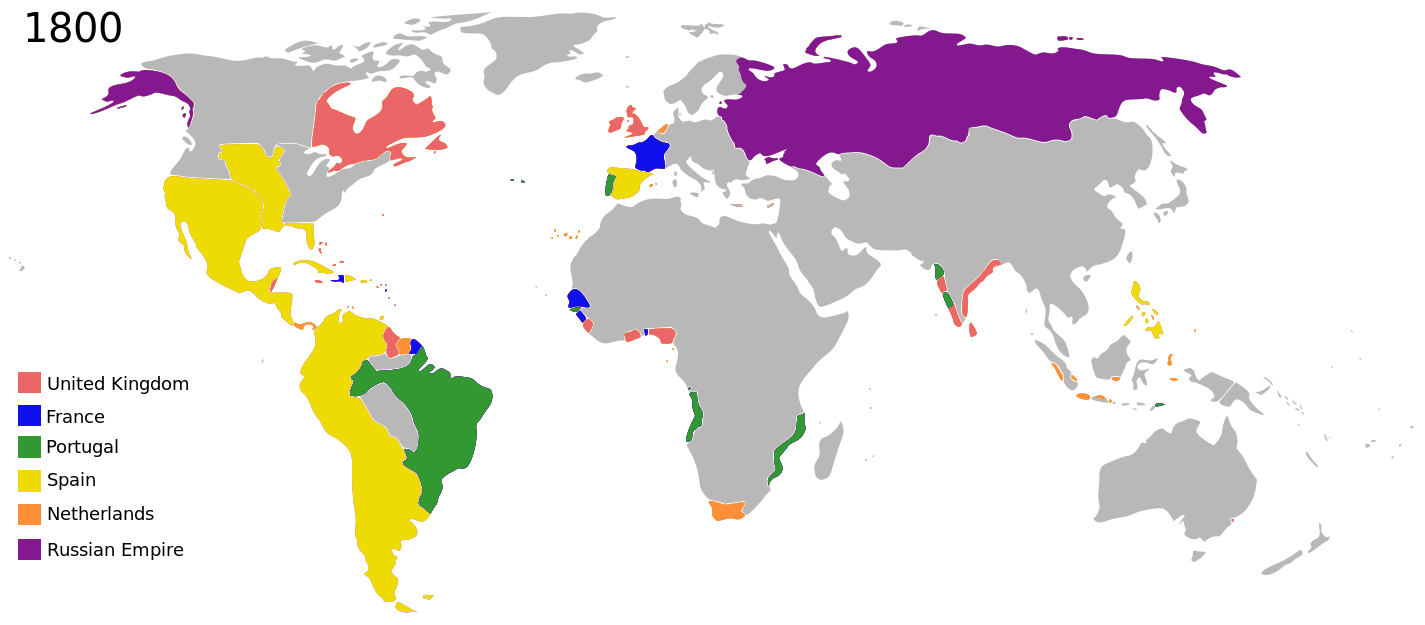
Colonial empires in 1800
|
| Date | |
| Source |
|
| Author | George Tsiagalakis |
|
Permission
( Reusing this file ) |
Please state licence(CC-BY-SA 4) and author when using this image |
| Other versions |
|
| Maps of world history | |
| BC | |
|
|
|
| AD |
1 · 50 · 100 · 200 · 250 · 300 · 400 · 500 · 700 · 750 · 820 · 900 · 1200 · 1500 · 1556 · 1648 · 1700 · 1750 · 1815 · 1859 · 1871 · 1914 · 1935 · 1954 · 1989 · 2000 · |
|
Maps of colonization history
|
|
|
see also:
Eastern Hemisphere only maps template
(1300BC-1500AD)
|
|
| (this template: · view · discuss ) | |
.jpg)
._LOC_2001620596.jpg)
Licensing
I, the copyright holder of this work, hereby publish it under the following license:
This file is licensed under the
Creative Commons
Attribution-Share Alike 4.0 International
license.
-
You are free:
- to share – to copy, distribute and transmit the work
- to remix – to adapt the work
-
Under the following conditions:
- attribution – You must give appropriate credit, provide a link to the license, and indicate if changes were made. You may do so in any reasonable manner, but not in any way that suggests the licensor endorses you or your use.
- share alike – If you remix, transform, or build upon the material, you must distribute your contributions under the same or compatible license as the original.
|
|
This is a
retouched picture
, which means that it has been digitally altered from its original version. The original can be viewed here:
Colonisation 1800.png
:
|
| Annotations | This image is annotated: View the annotations at Commons |