Comanche_Point,_on_the_South_Rim_of_the_Grand_Canyon.jpg
Size of this preview:
800 × 600 pixels
.
Other resolutions:
320 × 240 pixels
|
640 × 480 pixels
|
1,024 × 768 pixels
|
1,280 × 960 pixels
|
2,560 × 1,920 pixels
.
Summary
| Description |
English:
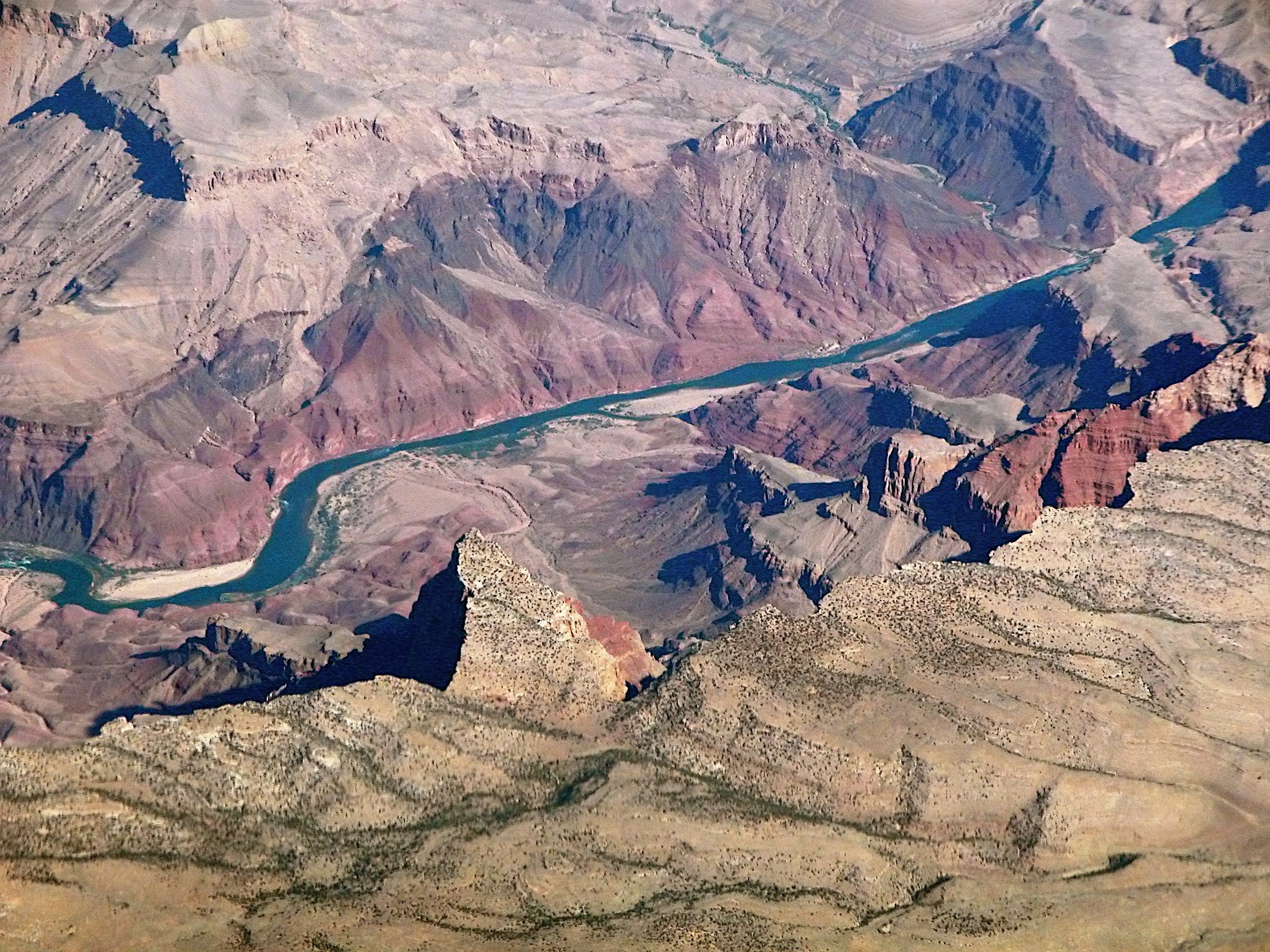
Comanche Point, on the South Rim of the Grand Canyon, above the Colorado River.
(about a 4.0 mile stretch of river)--Tanner Rapid-Mile 68.5, left (from Tanner Canyon), and Lava Creek (from North Rim), Mile 65.5 (aerial view)- Comanche Point , on the point-extension, & adjacent northeast is a view of the prominences of Espejo Butte ; the outfall regions of Tanner Creek & Comanche Creek, can be seen on the Colorado. |
| Date | |
| Source | san-den_053.JPG |
| Author | Doc Searls from Santa Barbara, USA |
Licensing
This file is licensed under the
Creative Commons
Attribution-Share Alike 2.0 Generic
license.
-
You are free:
- to share – to copy, distribute and transmit the work
- to remix – to adapt the work
-
Under the following conditions:
- attribution – You must give appropriate credit, provide a link to the license, and indicate if changes were made. You may do so in any reasonable manner, but not in any way that suggests the licensor endorses you or your use.
- share alike – If you remix, transform, or build upon the material, you must distribute your contributions under the same or compatible license as the original.
|
|
This image, originally posted to Flickr , was reviewed on 31 October 2011 by the administrator or reviewer Denniss , who confirmed that it was available on Flickr under the stated license on that date. |
| Annotations | This image is annotated: View the annotations at Commons |