Commanderie_Coulommiers.jpg
Size of this preview:
800 × 532 pixels
.
Other resolutions:
320 × 213 pixels
|
640 × 425 pixels
|
1,024 × 681 pixels
|
1,280 × 851 pixels
|
2,560 × 1,702 pixels
|
3,655 × 2,430 pixels
.
Summary

|
This is one of the images forming part of the
Valued image set
:
Commanderie de Coulommiers
on Wikimedia Commons. The image set has been assessed under the
valued image set criteria
and is considered
the most valued set on Commons
within the scope:
Commanderie de Coulommiers, France
(exterior)
You can see its nomination at Commons:Valued image candidates/Commanderie de Coulommiers . |
| Description |
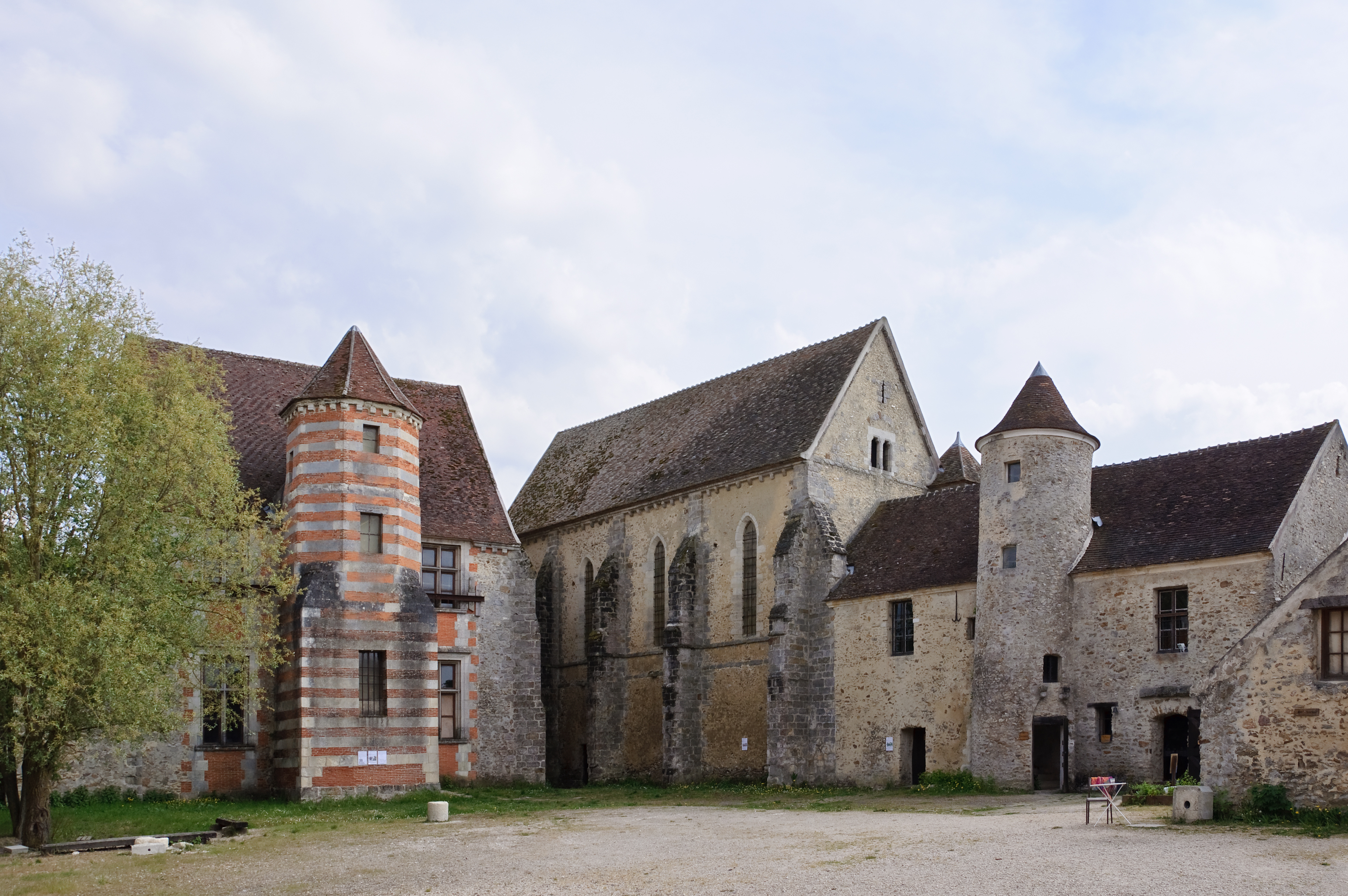
Français :
Ancienne
commanderie des Templiers à Coulommiers
(Seine-et-Marne, France) : le logis du commandeur (XIIe - XVIe siècle), la chapelle (XIIIe siècle), la maison du chapitre (XIIe siècle), le colombier (XVIIe siècle).
English:
Former Knights Templar commandery in Coulommiers (Seine-et-Marne, France): the house of the commander (12th - 16th-century), the chapel (13th-century), the chapter house (12th-century), the dovecote (17th-century).
Deutsch:
Frühere
Templer
-
Kommende
in
Coulommiers
(Dep. Seine-et-Marne. Frankreich): Kommandeurshaus (12.-16. Jh.), Kapelle (13. Jh.), Kapitelhaus (12. Jh.), Taubenschlag (17.Jh.)
|
||
| Date | |||
| Source | Own work | ||
| Author | Myrabella | ||
|
Attribution
( required by the license ) |
Photo: Myrabella / Wikimedia Commons / | ||
| Camera location |
|
View this and other nearby images on: OpenStreetMap |
|
|---|
|
|
This is a
retouched picture
, which means that it has been digitally altered from its original version. Modifications:
perspective correction; removal of two people by cloning
.
|
|
|
This image has been assessed using the
Quality image guidelines
and is considered a
Quality image
.
|
| Annotations | This image is annotated: View the annotations at Commons |
Licensing
I, the copyright holder of this work, hereby publish it under the following licenses:
This file is licensed under the
Creative Commons
Attribution-Share Alike 3.0 Unported
license.
-
You are free:
- to share – to copy, distribute and transmit the work
- to remix – to adapt the work
-
Under the following conditions:
- attribution – You must give appropriate credit, provide a link to the license, and indicate if changes were made. You may do so in any reasonable manner, but not in any way that suggests the licensor endorses you or your use.
- share alike – If you remix, transform, or build upon the material, you must distribute your contributions under the same or compatible license as the original.

|
Permission is granted to copy, distribute and/or modify this document under the terms of the GNU Free Documentation License , Version 1.2 or any later version published by the Free Software Foundation ; with no Invariant Sections, no Front-Cover Texts, and no Back-Cover Texts. A copy of the license is included in the section entitled GNU Free Documentation License . |
You may select the license of your choice.