Community_Hall,_Camooweal.jpg

Size of this preview:
800 × 527 pixels
.
Other resolutions:
320 × 211 pixels
|
640 × 422 pixels
|
965 × 636 pixels
.
Summary
| Description |
English:
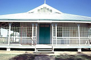
Community Hall, Camooweal
|
| Date | before 20 January 2016 |
| Source | State of Queensland: Queensland Heritage Register: Community Hall, Camooweal |
| Author | Heritage branch staff |
| Camera location |
|
View this and other nearby images on: OpenStreetMap |
|
|---|
Licensing
This file is licensed under the
Creative Commons
Attribution 3.0 Unported
license.
-
You are free:
- to share – to copy, distribute and transmit the work
- to remix – to adapt the work
-
Under the following conditions:
- attribution – You must give appropriate credit, provide a link to the license, and indicate if changes were made. You may do so in any reasonable manner, but not in any way that suggests the licensor endorses you or your use.