Compton_Wynyates_retouched.jpg
No higher resolution available.
Summary
| Description |
English:
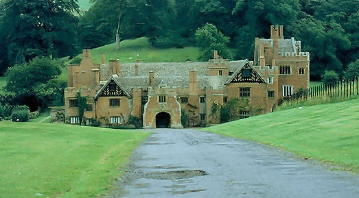
Compton Wynyates
|
| Date | |
| Source | By Row17, CC BY-SA 2.0, https://commons.wikimedia.org/w/index.php?curid=5218306 |
| Author | Row17 |
| Other versions |
|
|
Attribution
( required by the license ) |
Row17 / Compton Wynyates (circa 1983) / |

| Camera location |
|
View this and other nearby images on: OpenStreetMap |
|
|---|
_heading:90.00&language=en)
| Object location |
|
View this and other nearby images on: OpenStreetMap |
|
|---|
_heading:90.00&language=en)
Licensing
This file is licensed under the
Creative Commons
Attribution-Share Alike 2.0 Generic
license.
Attribution:
Row17
-
You are free:
- to share – to copy, distribute and transmit the work
- to remix – to adapt the work
-
Under the following conditions:
- attribution – You must give appropriate credit, provide a link to the license, and indicate if changes were made. You may do so in any reasonable manner, but not in any way that suggests the licensor endorses you or your use.
- share alike – If you remix, transform, or build upon the material, you must distribute your contributions under the same or compatible license as the original.
|
|
This file, which was originally posted to
By Row17, CC BY-SA 2.0,
https://www.geograph.org.uk/photo/759247
, was reviewed on 22 February 2016 by
reviewer
Leoboudv
, who confirmed that it was available there under the stated license on that date.
|