Confluence_of_the_rivers_Southern_Bug_and_Dnieper.jpg

Summary
| Description |
English:
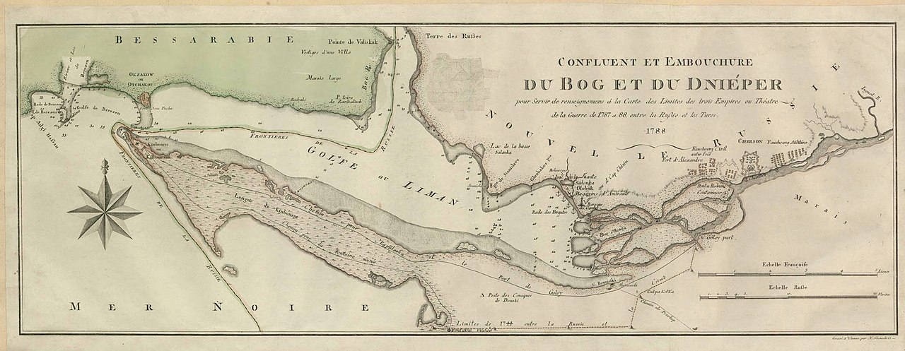
Map showing confluence of the rivers Southern Bug and Dnieper and the Dnieper-(Southern) Bug estuary. The map was created during the Russo-Turkish War of 1787–1792.
Svenska:
Karta över Dnipro-Buh estuariet.
|
||||||||||||||||||||||||||
| Date | |||||||||||||||||||||||||||
| Source |
Utländska kartor, Ryssland, hydrografiska kartor, SE/KrA/0403/34/A/022b, bildid: K0022144_00001 https://sok.riksarkivet.se/arkiv/pxt3CiEqjagtKneJgfRFN3 |
||||||||||||||||||||||||||
| Creator |
Unknown author
|
||||||||||||||||||||||||||
|
Permission
( Reusing this file ) |
|
||||||||||||||||||||||||||
| Georeferencing | If inappropriate please set warp_status = skip to hide. | ||||||||||||||||||||||||||


Licensing
|
|
This work is in the public domain in its country of origin and other countries and areas where the copyright term is the author's life plus 70 years or fewer .
|
| This file has been identified as being free of known restrictions under copyright law, including all related and neighboring rights. | |