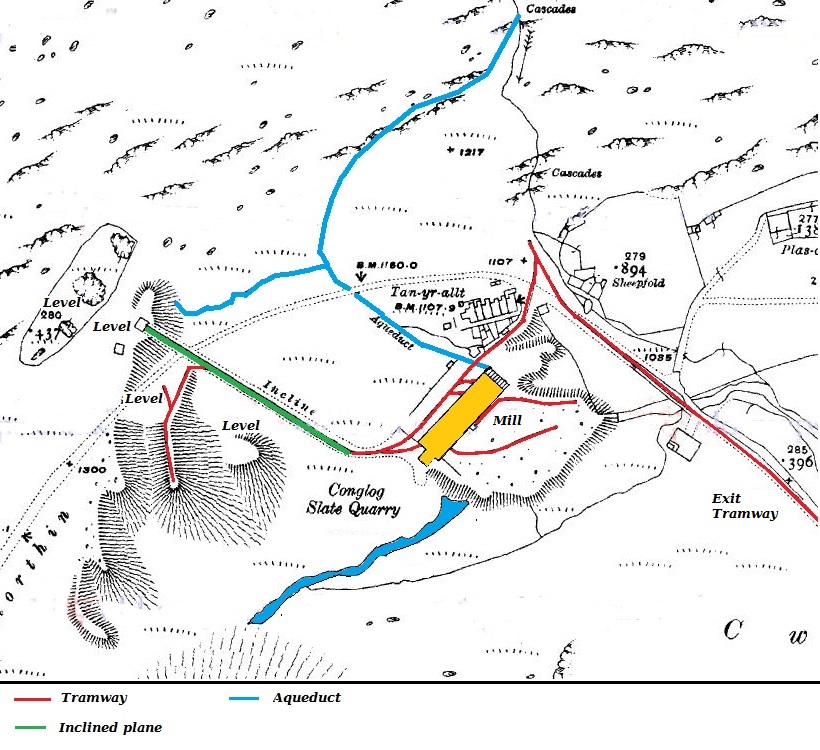
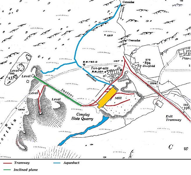
Conglog_1919.JPG
Size of this preview:
656 × 600 pixels
.
Other resolutions:
262 × 240 pixels
|
525 × 480 pixels
|
820 × 750 pixels
.
Summary
| Description |
English:
Map of Conglog Slate Quarry, Tanygrisiau, Wales, published in 1919, shortly after the quarry closed
|
| Date | |
| Source | Ordnance Survey 1:2500 map 1919 |
| Author | Ordnance Survey |
Licensing
|
|
This work
created by the United Kingdom Government
is in the
public domain
.
This is because it is one of the following :
HMSO has declared that the expiry of Crown Copyrights applies worldwide (ref:
HMSO Email Reply
)
|

|
The work is in the public domain because it was published by the Ordnance Survey and is more than 50 years old.