Conquista_Hispania.svg

Size of this PNG preview of this SVG file:
800 × 547 pixels
.
Other resolutions:
320 × 219 pixels
|
640 × 438 pixels
|
1,024 × 701 pixels
|
1,280 × 876 pixels
|
2,560 × 1,752 pixels
|
950 × 650 pixels
.
Summary
| Description |
Español:
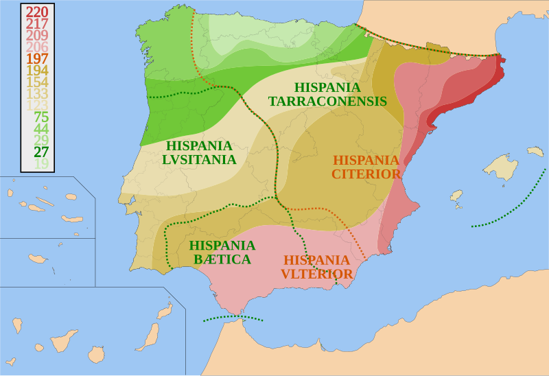
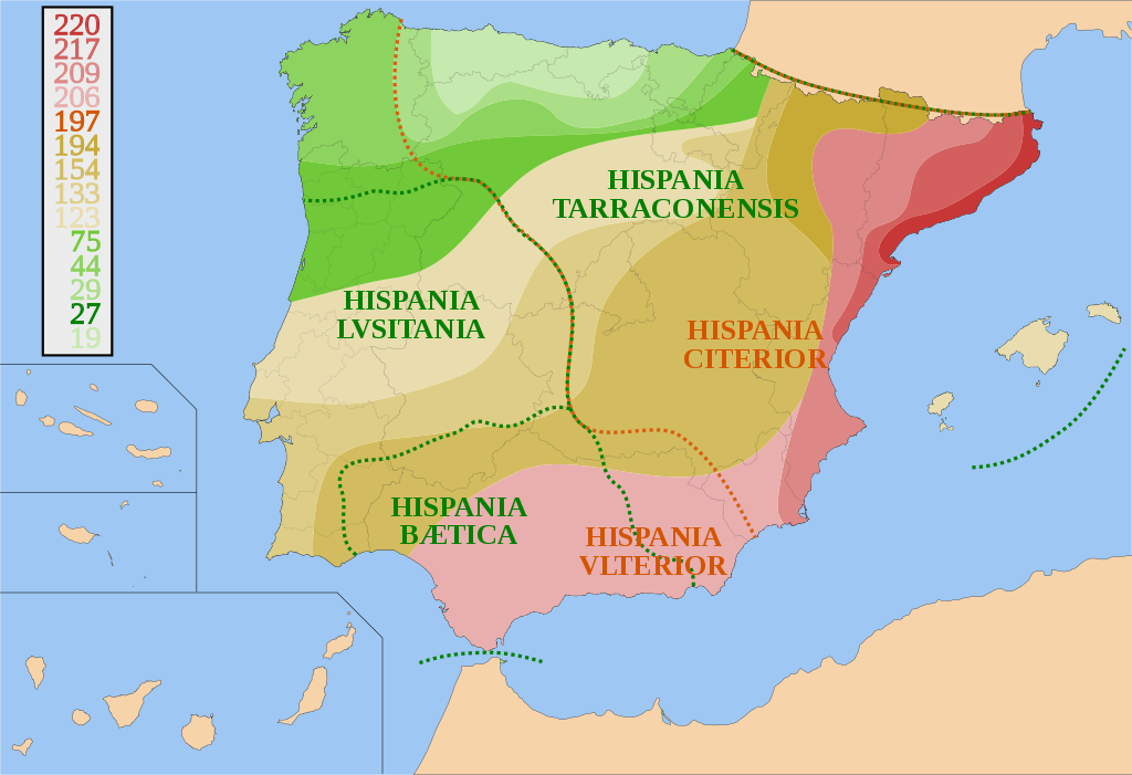
Mapa de España y Portugal sobre la conquista de Hispania desde 220 a.C. a 19 a.C. y sus fronteras provinciales. Basado en otros mapas, los avances territoriales y fronteras provinciales son orientativos.
Català:
Mapa d'Espanya i Portugal sobre la conquesta d'Hispania, des del 220 a.C. fins el 19 a.C. amb les fronteres provincials. És basat en altres mapes. Els avenços territorials i fronteres provincials són orientatius.
English:
Map of Spain and Portugal showing the conquest of Hispania from 220 B.C. to 19 B.C. and provincial borders. It is based on other maps; the territorial advances and provincial borders are illustrative.
|
| Date | |
| Source | Own work |
| Author | HansenBCN |
Licensing
I,
HansenBCN
, the copyright holder of this work, hereby publishes it under the following licenses:

|
Permission is granted to copy, distribute and/or modify this document under the terms of the GNU Free Documentation License , Version 1.2 or any later version published by the Free Software Foundation ; with no Invariant Sections, no Front-Cover Texts, and no Back-Cover Texts. A copy of the license is included in the section entitled GNU Free Documentation License . |
|
|
This file is licensed under the Creative Commons Attribution-Share Alike 3.0 Unported license. | |
| Attribution: I, HansenBCN | ||
|
||
| This licensing tag was added to this file as part of the GFDL licensing update . |
You may select the license of your choice.