County_population_map.webp

Size of this PNG preview of this WEBP file:
800 × 530 pixels
.
Other resolutions:
320 × 212 pixels
|
640 × 424 pixels
|
1,024 × 679 pixels
|
1,280 × 848 pixels
|
2,066 × 1,369 pixels
.
Summary
| Description |
English:
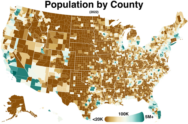
County population map of the United States. Connecticut data is missing.
|
| Date | |
| Source |
Own work
https://www.census.gov/data/tables/time-series/demo/popest/2020s-counties-total.html
|
| Author | Wikideas1 |
Licensing
I, the copyright holder of this work, hereby publish it under the following license:
|
|
This file is made available under the Creative Commons CC0 1.0 Universal Public Domain Dedication . |
|
The person who associated a work with this deed has dedicated the work to the
public domain
by waiving all of their rights to the work worldwide under copyright law, including all related and neighboring rights, to the extent allowed by law. You can copy, modify, distribute and perform the work, even for commercial purposes, all without asking permission.
|