Dardanelles_defences_1915.png
Size of this preview:
580 × 599 pixels
.
Other resolutions:
232 × 240 pixels
|
600 × 620 pixels
.

|
This
map
image could be re-created
using
vector graphics
as an
SVG
file
. This has several advantages; see
Commons:Media for cleanup
for more information. If an SVG form of this image is available, please upload it and afterwards replace this template with
{{

vector version available

|

new image name

}}
.
It is recommended to name the SVG file “Dardanelles defences 1915.svg”—then the template Vector version available (or Vva ) does not need the new image name parameter. |
Summary
| Description |
English:
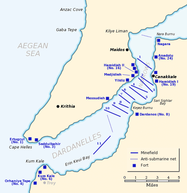
Map of the Dardanelles defences in February and March, 1915. The original lines of
naval mines
are numbered 1 to 10. The 11th line, laid in Erin Keui Bay by the minelayer
Nusrat
on 8 March, is numbered 11. The anti-submarine nets are shown as dotted lines. Major forts are indicated with blue boxes and the Turkish name and equivalent British number for the fort is given, if known.
|
| Date | |
| Source |
Own work based on:
|
| Author | Gsl |
|
Permission
( Reusing this file ) |
Released to public domain |
|
|
This work has been released into the
public domain
by its author,
Gsl
. This applies worldwide.
In some countries this may not be legally possible; if so:
|