De_Smet_map_of_the_1851_Fort_Laramie_Indian_territories_(the_light_area)._PNG.png

Size of this preview:
800 × 536 pixels
.
Other resolutions:
320 × 214 pixels
|
640 × 429 pixels
|
1,024 × 686 pixels
|
1,280 × 857 pixels
|
2,560 × 1,714 pixels
|
4,255 × 2,849 pixels
.
Summary
| Description |
English:
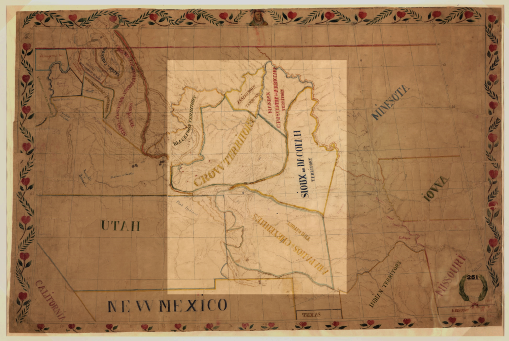
Map of Pierre-Jean De Smet in 1851. The Indian territories agreed upon in the Fort Laramie Treaty (1851) is shown in the light area: Assiniboine, Arikara, Hidatsa and Mandan, Sioux (Dakota or Lakota), Crow, Arapaho and Cheyenne
|
| Date | |
| Source | Map of the upper Great Plains and Rocky Mountains region. |
| Author | Pierre-Jean De Smet (1801-1873) |
North America, US, North Dakota, South Dakota, Montana, Nebraska, Colorado, Wyoming
Licensing
|
|
This work is in the public domain in its country of origin and other countries and areas where the copyright term is the author's life plus 70 years or fewer . This work is in the public domain in the United States because it was published (or registered with the U.S. Copyright Office ) before January 1, 1929. |
| This file has been identified as being free of known restrictions under copyright law, including all related and neighboring rights. | |