Details_of_MESSENGER's_Impact_Location.jpg

Size of this preview:
540 × 599 pixels
.
Other resolutions:
216 × 240 pixels
|
433 × 480 pixels
|
692 × 768 pixels
|
1,262 × 1,400 pixels
.
Summary
| Description |
English:
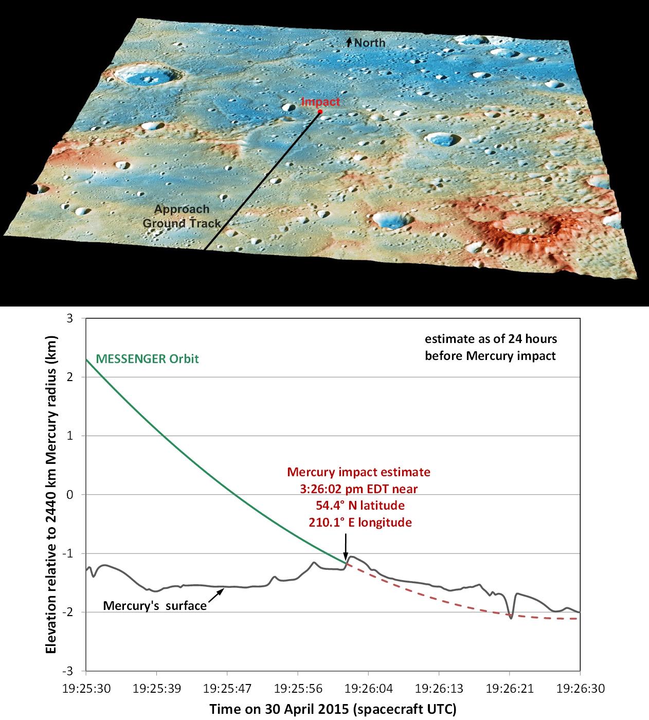
These graphics show the current best prediction of the location and time of MESSENGER's impact on Mercury's surface, as of 24 hours before the impact. Those current best estimates are:
|
| Date | |
| Source | DETAILS OF MESSENGER'S IMPACT LOCATION ( image link ) |
| Author | NASA/Johns Hopkins University Applied Physics Laboratory/Carnegie Institution of Washington |
| Other versions | http://photojournal.jpl.nasa.gov/jpeg/PIA19443.jpg |
Licensing
|
|
This file is in the public domain in the United States because it was solely created by NASA . NASA copyright policy states that "NASA material is not protected by copyright unless noted ". (See Template:PD-USGov , NASA copyright policy page or JPL Image Use Policy .) |
|

|
Warnings:
|