Diane_1955_floods.png
No higher resolution available.
Summary
| Description |
English:
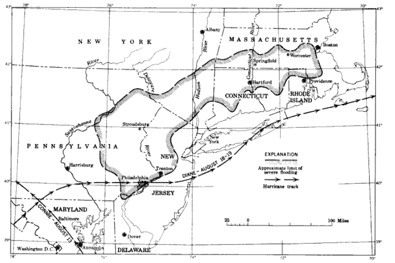
Map of the area of severe flooding August 18-19, showing tracks of the August hurricanes, Connie and Diane
|
| Date | |
| Source | https://books.google.com/books?id=MEo-AQAAIAAJ&pg=PA2&dq=hurricane+diane&hl=en&sa=X&ei=lX0WUaPHN6m50AHSk4GoDQ&ved=0CC0Q6AEwADgU#v=onepage&q=hurricane%20diane&f=false |
| Author | United States Geological Survey |
Licensing
|
|
This image is in the
public domain
in the United States because it only contains materials that originally came from the
United States Geological Survey
, an agency of the
United States Department of the Interior
. For more information, see
the official USGS copyright policy
.
|
|