Distribution_of_US_Rural_Population_during_1900.pdf

Size of this JPG preview of this PDF file:
800 × 535 pixels
.
Other resolutions:
320 × 214 pixels
|
640 × 428 pixels
|
1,024 × 684 pixels
|
1,280 × 855 pixels
|
2,472 × 1,652 pixels
.
Summary
| Description |
English:
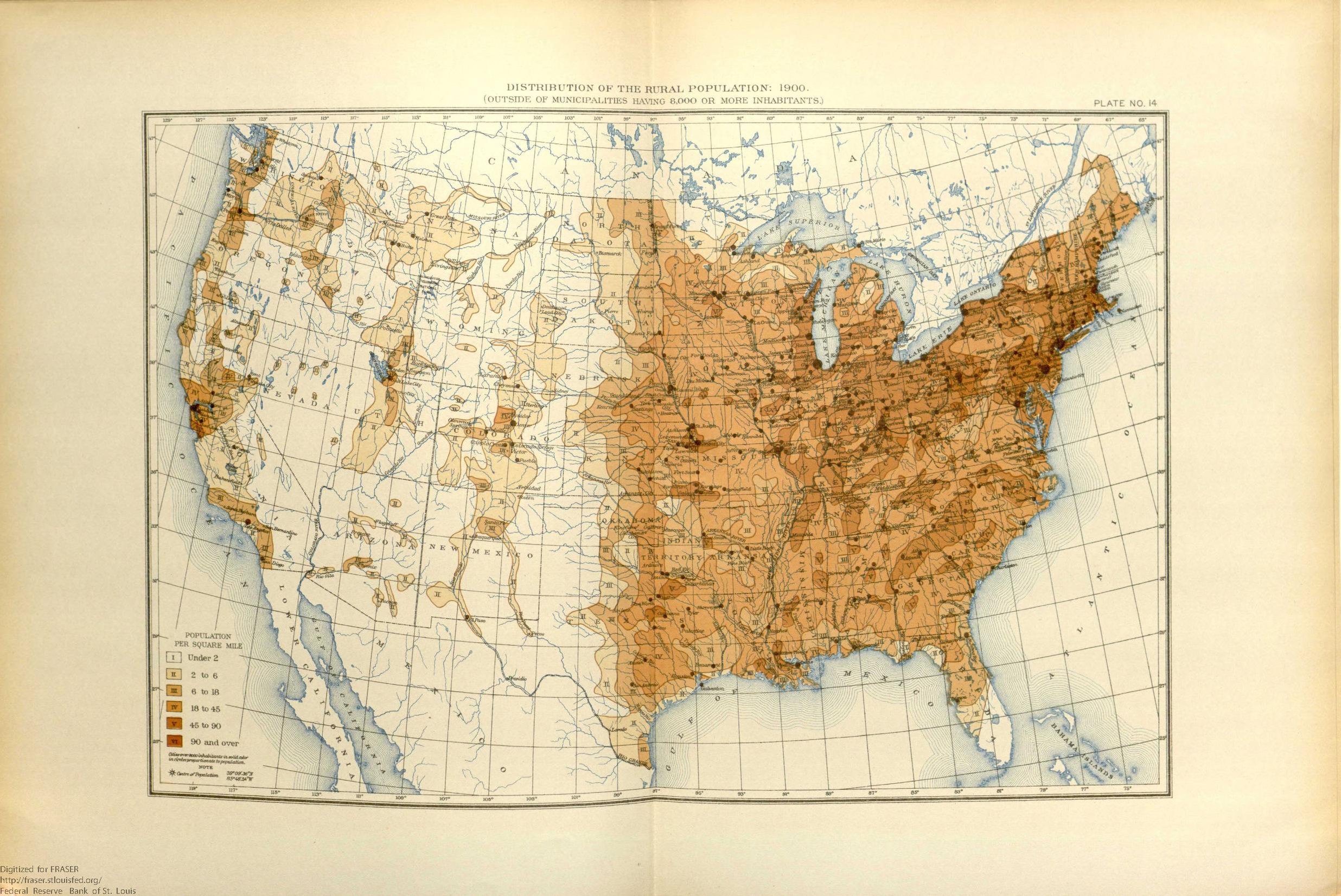
This map shows the population distribution of the 45 states and 4 territories of the mainland United States and the extent of the frontier line by 1900.
|
| Date | |
| Source | United States. Bureau of the Census. Statistical Atlas of the United States, 1910 , 1914, https://fraser.stlouisfed.org/title/74 , accessed on January 7, 2020. |
| Author | United States Census Bureau |
Licensing
|
|
This image or file is a work of a
United States Census Bureau
employee, taken or made as part of that person's official duties. As a
work
of the
U.S. federal government
, the image is in the
public domain
.
|

|