Distribution_of_loess_in_North_America.gif
No higher resolution available.
Summary
| Description |
English:
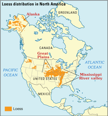
Map showing the distribution of loess (orange) in North America.
|
| Date | |
| Source | http://gec.cr.usgs.gov/archive/eolian/task2.shtml |
| Author | Muhs et al / USGS |
|
|
This image is in the
public domain
in the United States because it only contains materials that originally came from the
United States Geological Survey
, an agency of the
United States Department of the Interior
. For more information, see
the official USGS copyright policy
.
|
|
Licensing
|
|
This image is in the
public domain
in the United States because it only contains materials that originally came from the
United States Geological Survey
, an agency of the
United States Department of the Interior
. For more information, see
the official USGS copyright policy
.
|
|