Donau_Einzugsgebiet.png
Size of this preview:
800 × 427 pixels
.
Other resolutions:
320 × 171 pixels
|
640 × 342 pixels
|
1,024 × 547 pixels
|
1,280 × 683 pixels
|
2,130 × 1,137 pixels
.
Summary
| Description |
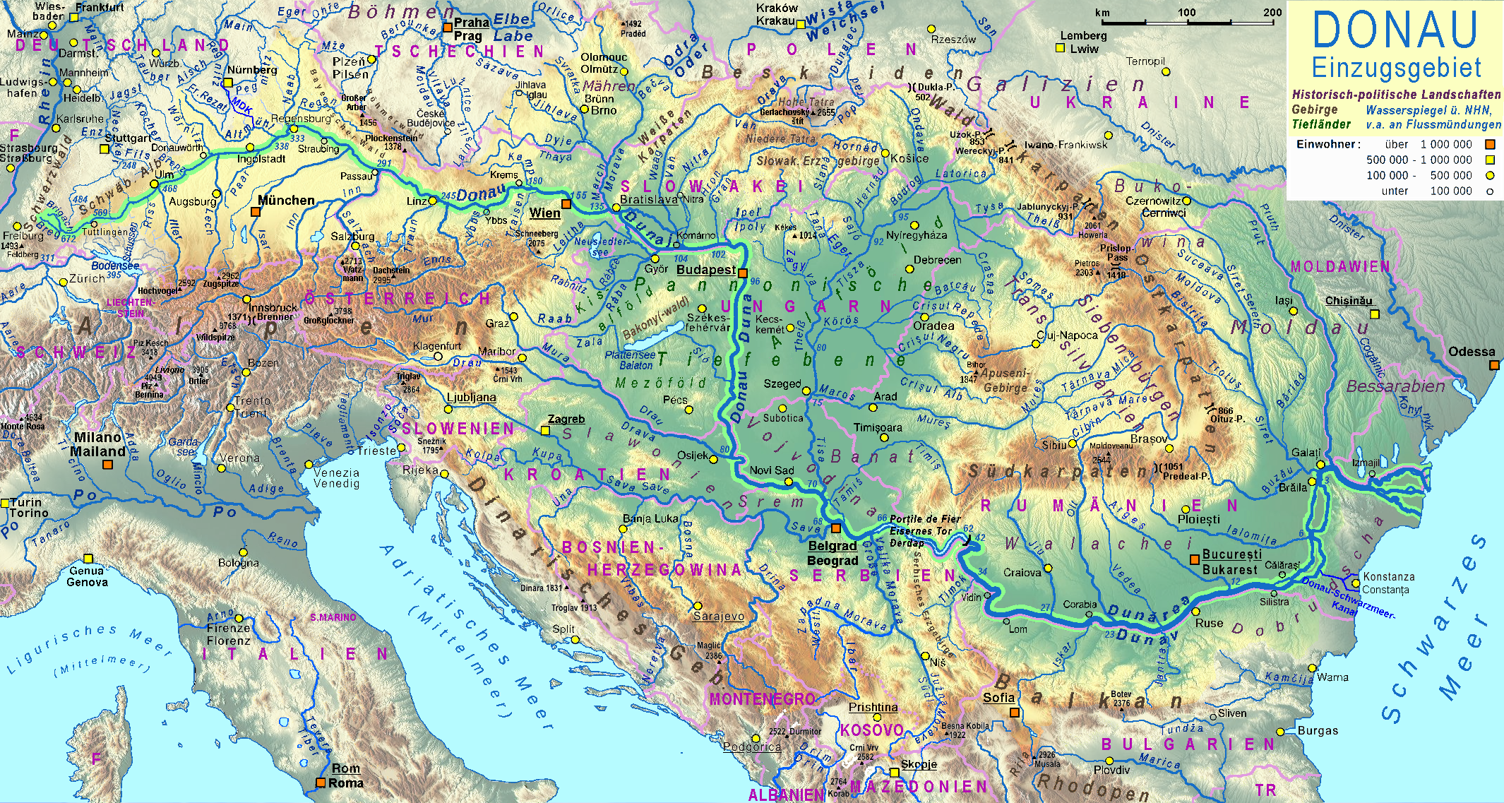
Deutsch:
Einzugsgebiet der Donau
English:
Basin of the River Danube
|
| Date | 2011-10-10, major revision 2016-04-13…15 |
| Source |
|
| Author | TomGonzales , major revision by Ulamm in April 2016 |
| Other versions | file:Tisza Karte.png , file:Aliniamentul Sava-Dunăre.png |

|
This map has been made or improved in the German
Kartenwerkstatt
(Map Lab)
. You can
propose maps
to improve as well.
|
Licensing
I, the copyright holder of this work, hereby publish it under the following license:
This file is licensed under the
Creative Commons
Attribution-Share Alike 2.0 Generic
license.
-
You are free:
- to share – to copy, distribute and transmit the work
- to remix – to adapt the work
-
Under the following conditions:
- attribution – You must give appropriate credit, provide a link to the license, and indicate if changes were made. You may do so in any reasonable manner, but not in any way that suggests the licensor endorses you or your use.
- share alike – If you remix, transform, or build upon the material, you must distribute your contributions under the same or compatible license as the original.