Donington_as_of_2010.svg

Size of this PNG preview of this SVG file:
800 × 555 pixels
.
Other resolutions:
320 × 222 pixels
|
640 × 444 pixels
|
1,024 × 710 pixels
|
1,280 × 888 pixels
|
2,560 × 1,776 pixels
|
1,338 × 928 pixels
.
| Description |
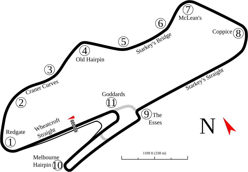
English:
Track map for
Donington Park
as of
2010
. This may or may not be the current version of the track. This is as shown in Google Earth as of the creation date.
|
| Date | (UTC) |
| Source | |
| Author |
|
| Other versions |

|
|
|
This is a
retouched picture
, which means that it has been digitally altered from its original version. Modifications:
small change to track
. The original can be viewed here:
Donington as of 2006.svg
:
|
I, the copyright holder of this work, hereby publish it under the following license:
This file is licensed under the
Creative Commons
Attribution-Share Alike 3.0 Unported
license.
-
You are free:
- to share – to copy, distribute and transmit the work
- to remix – to adapt the work
-
Under the following conditions:
- attribution – You must give appropriate credit, provide a link to the license, and indicate if changes were made. You may do so in any reasonable manner, but not in any way that suggests the licensor endorses you or your use.
- share alike – If you remix, transform, or build upon the material, you must distribute your contributions under the same or compatible license as the original.
Original upload log
This image is a derivative work of the following images:
-
File:Donington_as_of_2006.svg
licensed with Cc-by-sa-3.0
- 2008-09-02T12:36:47Z Will Pittenger 1338x928 (45270 Bytes) Found that a name (for a straight) was missing and added that.
- 2008-09-02T12:17:54Z Will Pittenger 1338x928 (43445 Bytes) {{Information |Description={{en|1=Track map for [[w:Donington Park|]] as of [[w:2006|]]. This may or may not be the current version of the track. Changes are expected by [[w:2010]]. This is as shown in Google Earth as of t
Uploaded with derivativeFX