Everglades_ecoregion.jpg
No higher resolution available.
Summary
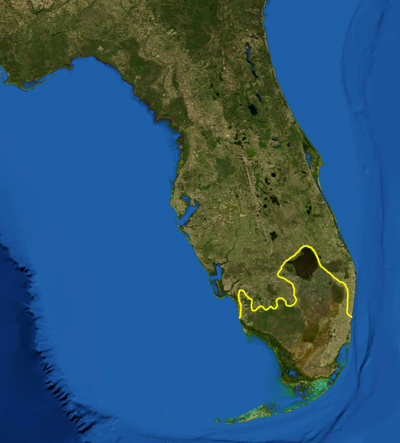
| Description | This is a map showing the location of the Everglades . The yellow line encloses ecoregions as delineated by the World Wide Fund for Nature : the "Everglades" (NT0904) and the "South Florida rocklands" (NT0164). I, Pfly , made it using NASA Blue Marble imagery and ecoregion GIS data which I simplified and digitized in Photoshop. |
| Date | |
| Source | NASA, plus my additions by myself. |
| Author | Pfly |
Licensing
|
|
This file is in the public domain in the United States because it was solely created by NASA . NASA copyright policy states that "NASA material is not protected by copyright unless noted ". (See Template:PD-USGov , NASA copyright policy page or JPL Image Use Policy .) |
|

|
Warnings:
|