Expansión_peninsular_de_la_Corona_de_Aragón.png
Size of this preview:
800 × 532 pixels
.
Other resolutions:
320 × 213 pixels
|
640 × 425 pixels
|
1,024 × 681 pixels
|
1,280 × 851 pixels
|
2,560 × 1,701 pixels
|
3,775 × 2,509 pixels
.
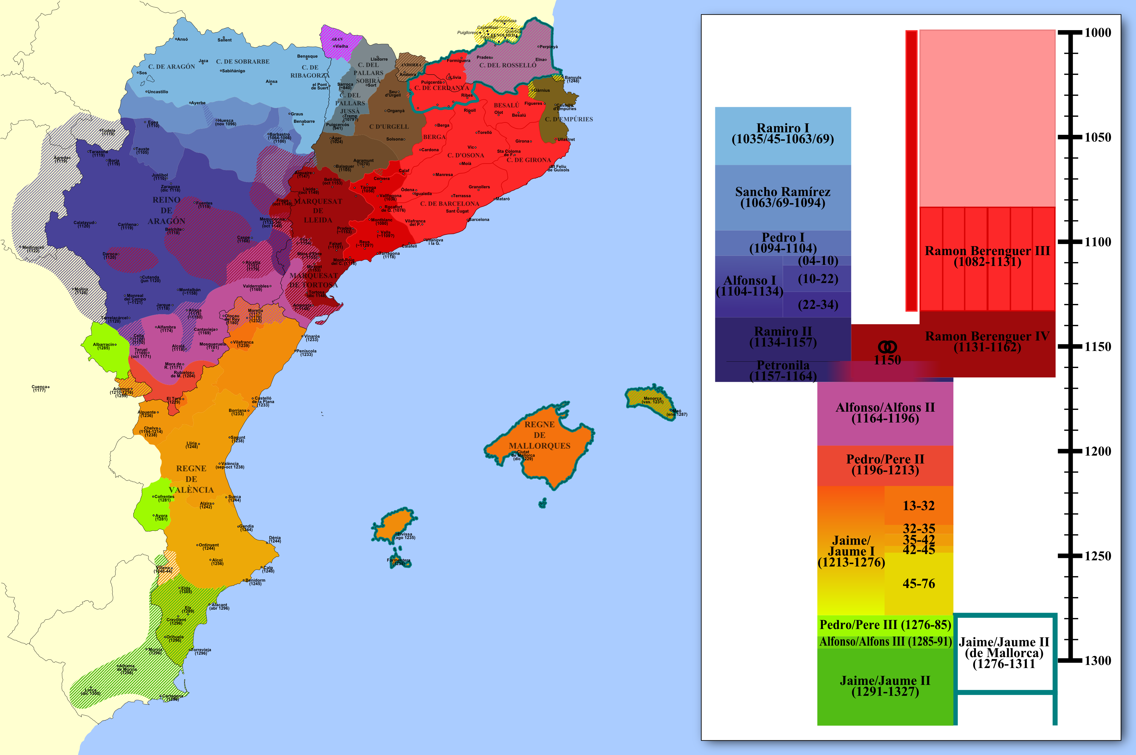
Summary
| Description |
Español:
Mapa de la expansión de la Corona de Aragón en territorio balear y peninsular coloreado según monarcas y fases de conquista y fechado. Proyección de Mercator.
|
||
| Date | 10-13/sept/2008 | ||
| Source | Own work | ||
| Author | HansenBCN | ||
|
Permission
( Reusing this file ) |
I, the copyright holder of this work, hereby publish it under the following licenses:
This file is licensed under the
Creative Commons
Attribution-Share Alike 3.0 Unported
license.
You may select the license of your choice.
|
||
| Other versions |
|


