Faroe_Islands,_Eysturoy,_Skipanes_and_Undir_Gøtueiði.jpg

Size of this preview:
800 × 531 pixels
.
Other resolutions:
320 × 213 pixels
|
640 × 425 pixels
|
1,024 × 680 pixels
|
1,280 × 850 pixels
|
1,930 × 1,282 pixels
.
Summary
| Description |
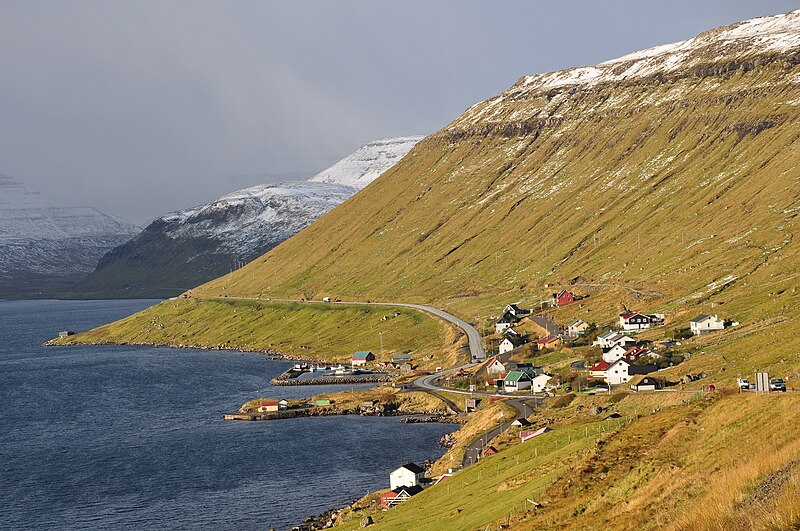
English:
The villages of Skipanes and Undir Gøtueiði along Skálafjørður melt together in this picture, taken from the Steðgipláss roundabout, looking to the NW.
Nederlands:
De dorpjes Skipanes en Undir Gøtueiði liggen aan de Skálafjørður en smelten in deze foto samen tot één dorp. De foto is genomen vanaf de Steðgipláss rotonde, kijkend naar het NW.
|
| Date | |
| Source | Own work |
| Author | Vincent van Zeijst |
•
| Camera location |
|
View this and other nearby images on: OpenStreetMap |
|
|---|
Licensing
I, the copyright holder of this work, hereby publish it under the following license:
This file is licensed under the
Creative Commons
Attribution-Share Alike 3.0 Unported
license.
-
You are free:
- to share – to copy, distribute and transmit the work
- to remix – to adapt the work
-
Under the following conditions:
- attribution – You must give appropriate credit, provide a link to the license, and indicate if changes were made. You may do so in any reasonable manner, but not in any way that suggests the licensor endorses you or your use.
- share alike – If you remix, transform, or build upon the material, you must distribute your contributions under the same or compatible license as the original.