Felix_from_ISS_03_sept_2007_1138Z.jpg

Size of this preview:
800 × 545 pixels
.
Other resolutions:
320 × 218 pixels
|
640 × 436 pixels
|
1,024 × 698 pixels
|
1,280 × 873 pixels
|
2,772 × 1,890 pixels
.
|
Summary
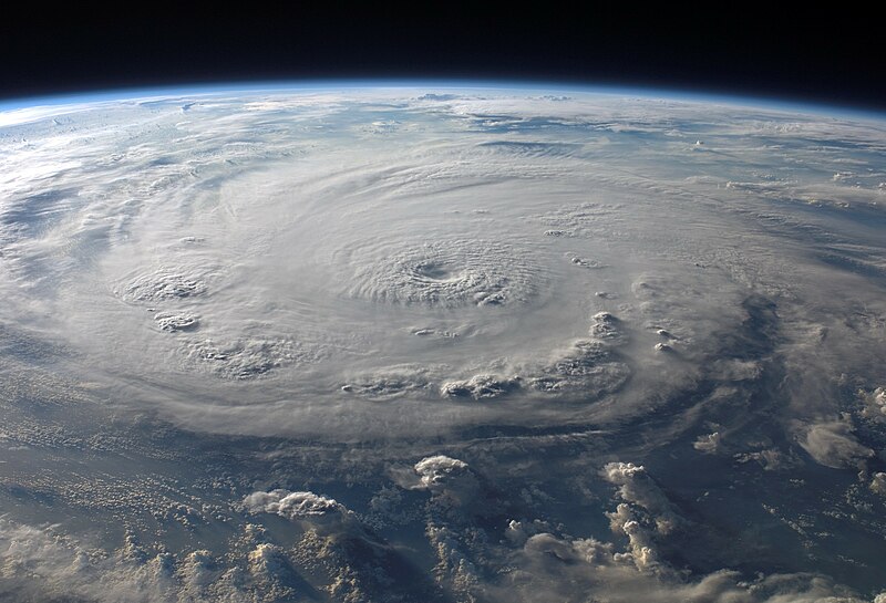
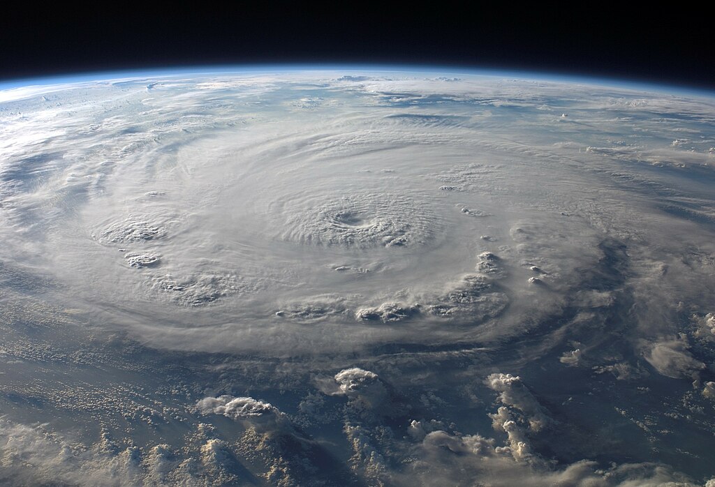
| Description | ISS015-E-25049 (3 Sept. 2007) --- This view of Hurricane Felix was taken from the Earth-orbiting International Space Station by an Expedition 15 crewmember using a digital still camera equipped with a 28-70 mm lens set at 28 mm focal length on Sept. 3, 2007 at 11:38:46 GMT. The ISS was located at the nadir point of 16.9 degrees north latitude and 83.3 degrees west longitude, over the waters southwest of Grand Cayman Island . At approximately noon GMT, Hurricane Felix was near 14.2 degrees north latitude and 76.9 west longitude, about 260 miles (425 kilometers) south of Kingston, Jamaica , and 425 miles (685 kilometers) east of Cabo Gracias a Dios on the Nicaragua / Honduras border, moving west at 21 miles per hour (33 kilometers per hour). The sustained winds were 165 miles per hour with higher gusts making it a category 5 on the Saffir-Simpson Hurricane Scale . | |||||
| Date | ||||||
| Source | http://www.nasa.gov/mission_pages/station/multimedia/exp15_hurricane_felix.html | |||||
| Author | NASA | |||||
|
Permission
( Reusing this file ) |
|
|||||
| Other versions |


|
|
This image or video was catalogued by one of the centers of the United States
National Aeronautics and Space Administration
(NASA) under
Photo ID:
ISS015-E-25049
.
This tag does not indicate the copyright status of the attached work. A normal copyright tag is still required. See Commons:Licensing .
Other languages:
|